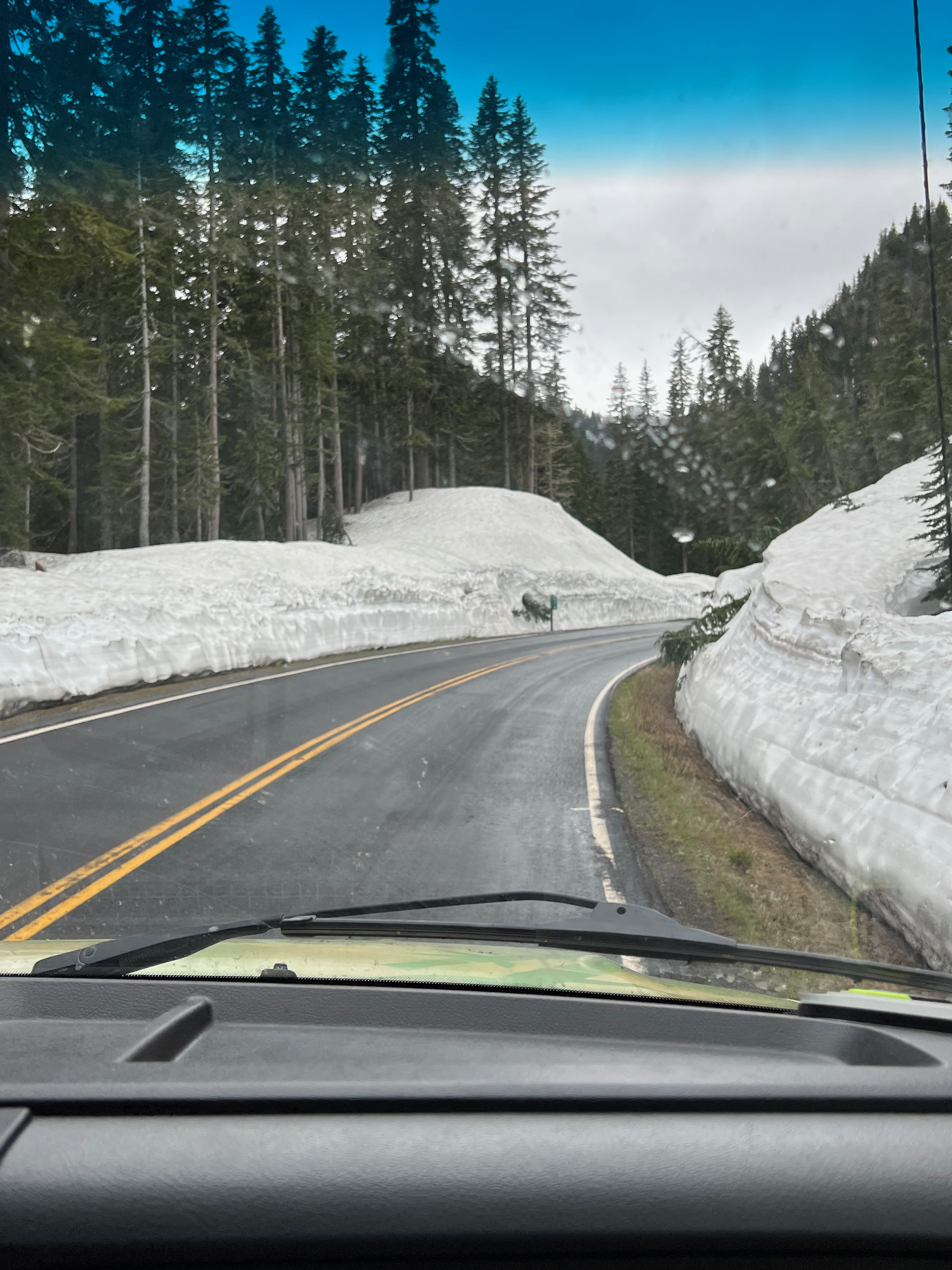
Washington Road Trip: Snoqualmie to Seattle

Enumclaw/Snoqualmie

I wake up thinking, yeah I definitely did too much yesterday. We sleep in the latest we have all week. I’m ready to be lazy and I’m still craving a view of Mount Rainier, and there’s a clear forecast until noon, so we decide to take the gondola from Crystal Mountain Resort. We arrive within minutes of it opening, and it’s just us and about a dozen or so snowboarders hanging around.

Have I ever mentioned I’m terrified of heights? Probably once or twice? The gondola is an enclosed glass cube with two bench seats, and I manage to stay pretty calm during our 2,400-ft vertical ascent. At the summit, we’re greeted by a view of Mount Rainier through some wispy cloud coverage. Victory! The wind is whipping our hair around and I am extremely sketched out by the lack of railings around the brick walkway, but we get our summit photos then boot-scoot-boogie over to the restaurant at the top of the mountain for breakfast. We’re seated at a window facing Mt. Rainier so I get to stare at it to my heart’s content as I have my coffee and BLT. I live in Illinois; I’m going to savor this moment.

Mount Rainier

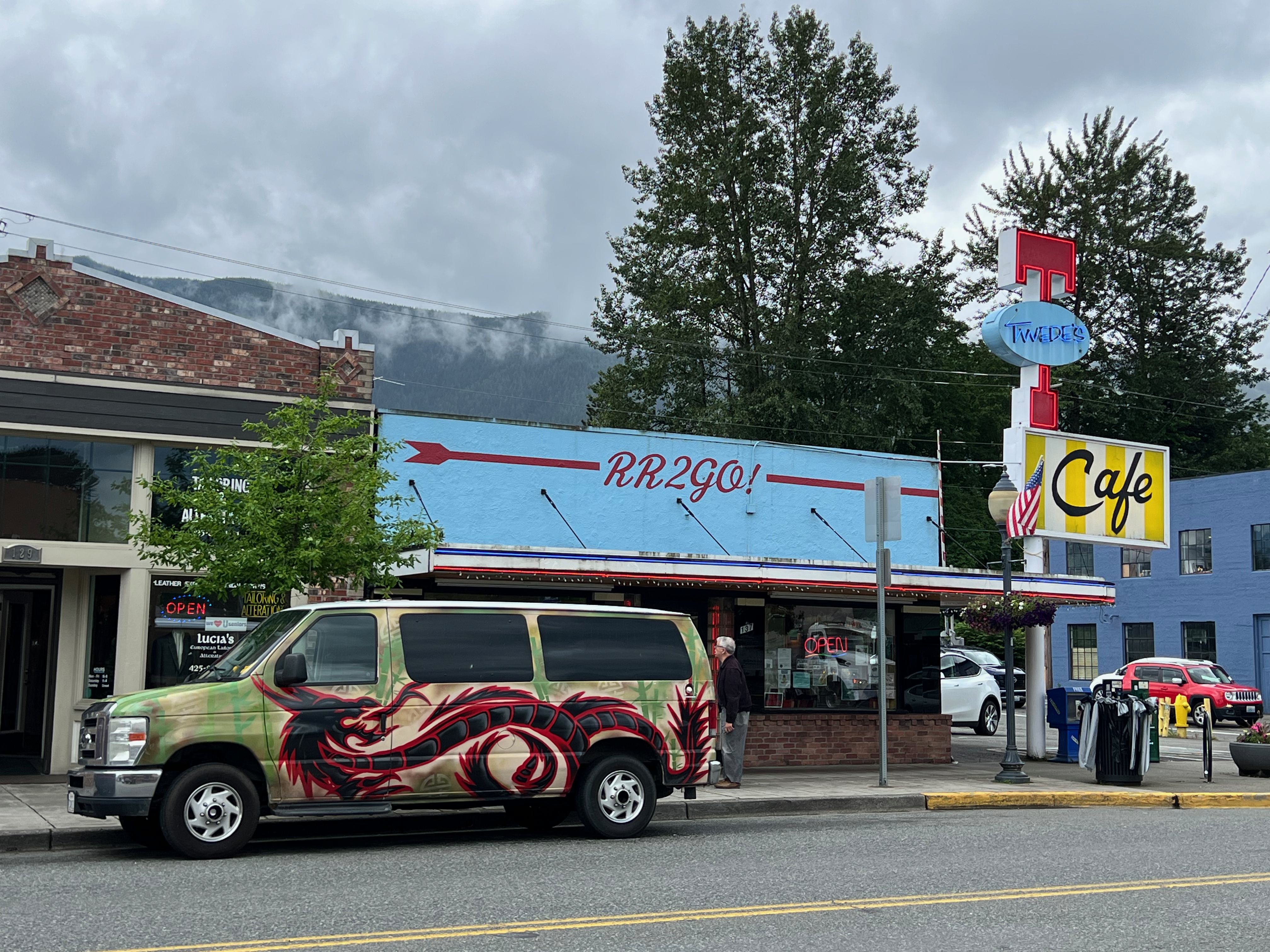
With our first mission accomplished, we leave Enumclaw and drive for an hour towards Snoqualmie. I’m extremely excited for this part of our trip because I’ve been a massive fan of the David Lynch/Mark Frost-created TV show Twin Peaks since it first aired (I was in sixth grade and didn’t really know what I was watching but I was intrigued. I later binge-watched the series on VHS in high school, and multiple times since). First thing first, we go to Twede’s Diner (a.ka. The Double R) so I can order a damn fine cup of coffee, black as midnight on a moonless night, with a slice of cherry pie.

“This must be where pies go when they die!”

I have an internet-gleaned list of filming locations on my to-do list, so one by one, we check them off. Ronette’s bridge, check. The Twin Peaks Sheriff’s Station, now a rally driving school with a view of the Packard Sawmill, check. (The incredibly nice woman at the front entrance even let me sit at Lucy’s desk for a photo.) The Salish Lodge & Spa (a.k.a. The Great Northern Hotel) and Snoqualmie Falls, check. Oh Diane, I almost forgot, got to find out what kind of trees these are! They’re really something.

“I believe I was visited by a Giant last night…”

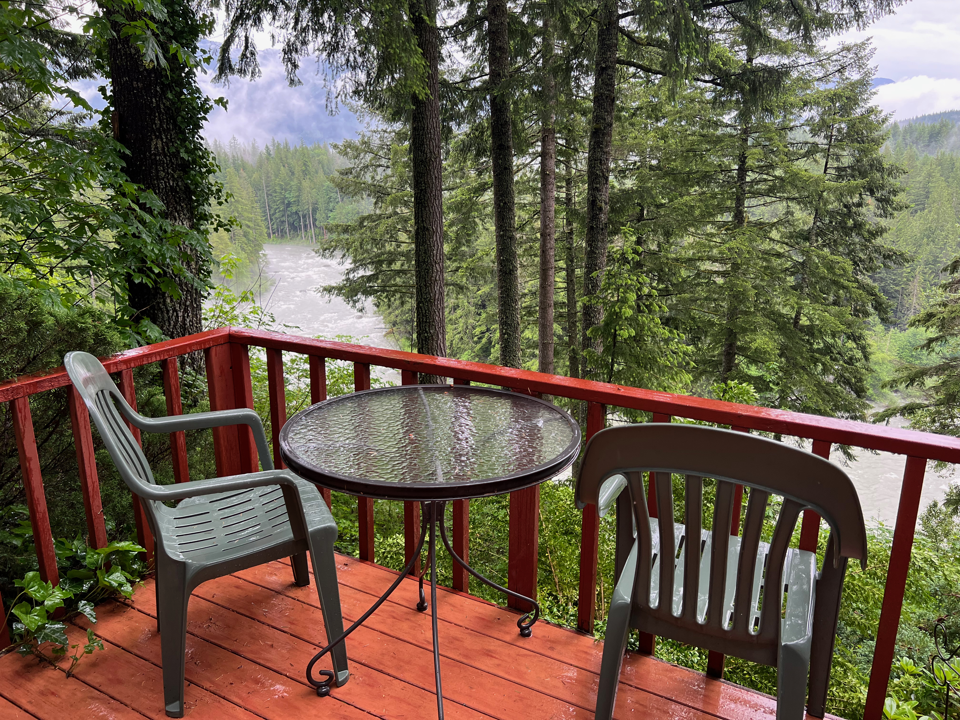
We are staying at a bed&breakfast in Snoqualmie for the night, and our room overlooks the river with a view of the forest and mountains. Also, there’s a gigantic boulder in our room, which feels appropriately Twin Peaksian (also doesn’t hurt that behind the boulder we have a private sauna room).

The Rock and Rose Room

Snoqualmie/Seattle

The b&b owners drop us off a hot breakfast in a wicker basket in the morning (this is probably the closest I’ll ever get to a MacDowell residency experience). We eat our French toast bake, breakfast sausage, and berries and cream while drinking in the last of the view. It’s the last full day of our trip (sobs) but I’d like to live here in this exact spot forever if someone can please fly our dog and cat over for me.

our view of the Middle Fork Snoqualmie River

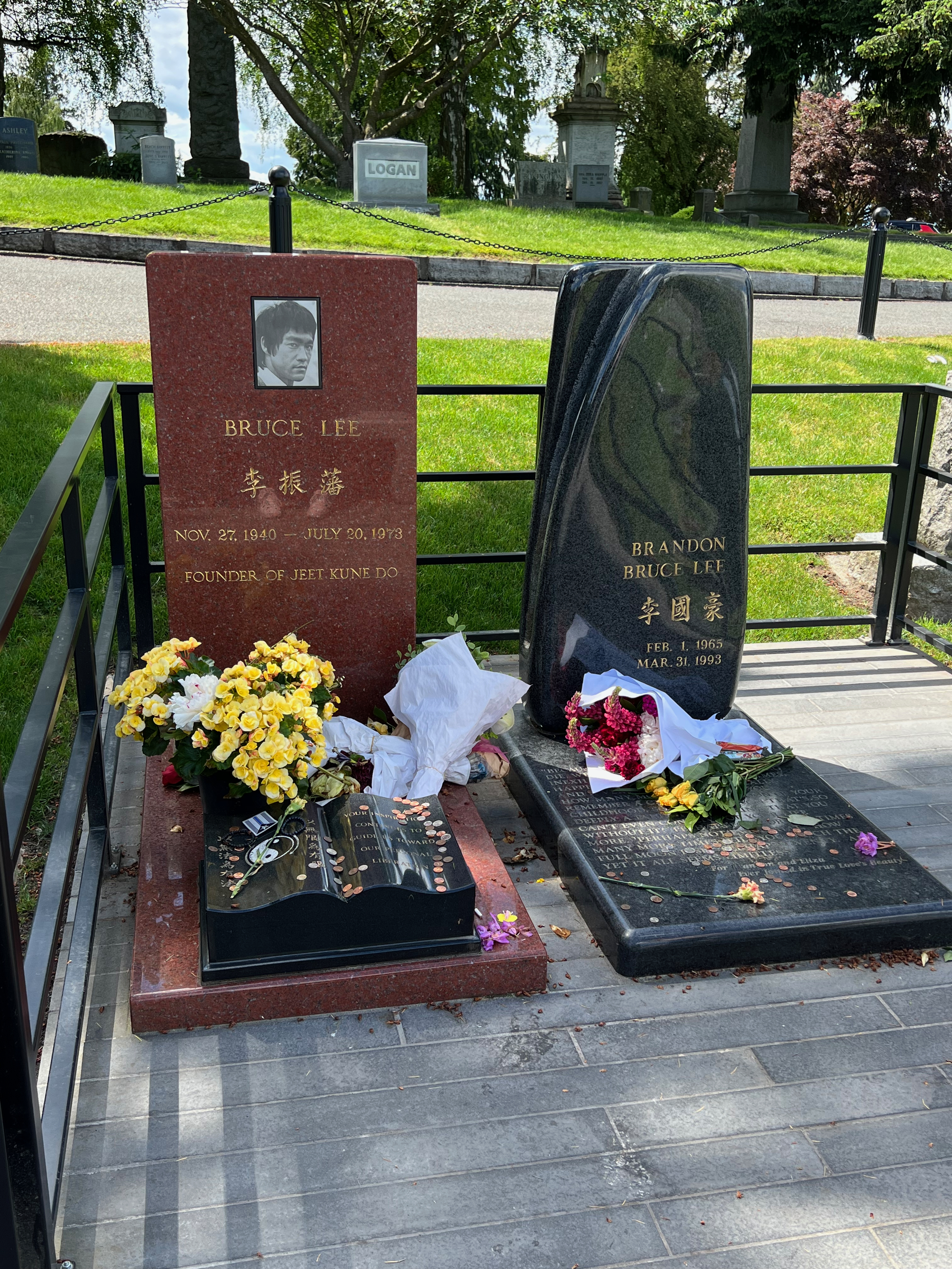
The first task of the day is to return the van to the rental place. Goodbye, Kung Fu, you were a fantastic home for the past week. We take a Lyft to the Capitol Hill area of Seattle and drop our stuff off at our final Airbnb. I have one more pilgrimage I want to make; I want to visit the graves of Bruce Lee and Brandon Lee at Lake View Cemetery in the nearby-ish Volunteer Park. It’s gotten quite warm out, and I begin to get tired, sweaty, and grumpy. I kinda forgot until now that it’s summer. Whose idea was this? (Mine). Maybe we should quit (I shouldn’t quit, we’re almost there). My feet hurt and my back is sweaty. I’ve had a weird time managing my moods ever since I had covid. We reach the cemetery entrance and notice a steady stream of people headed in the same direction. The small crowd grows quiet and respectfully somber. From what I’ve read, Bruce Lee’s family chose Seattle as his resting place because it’s where he fell in love and spent the happiest years of his life. It’s moving to see and experience with strangers and fellow fans. I’m glad I didn’t give up just because my feet hurt.

For the rest of the day, Kurt and I take it easy sampling local beers, eating fresh poke, and topping everything off with a cocktail. My Gen X heart enjoys and appreciates Seattle. It gave us one of the best seasons of The Real World (“Kirrrraaa! I love you! It kills me!!! and you don’t even knowww!!!!”) Ironically, the first time I visited Seattle back in 2012 I was getting over whooping cough; hopefully someday I’ll come back here totally free of any sort of respiratory issues.

Final Thoughts:

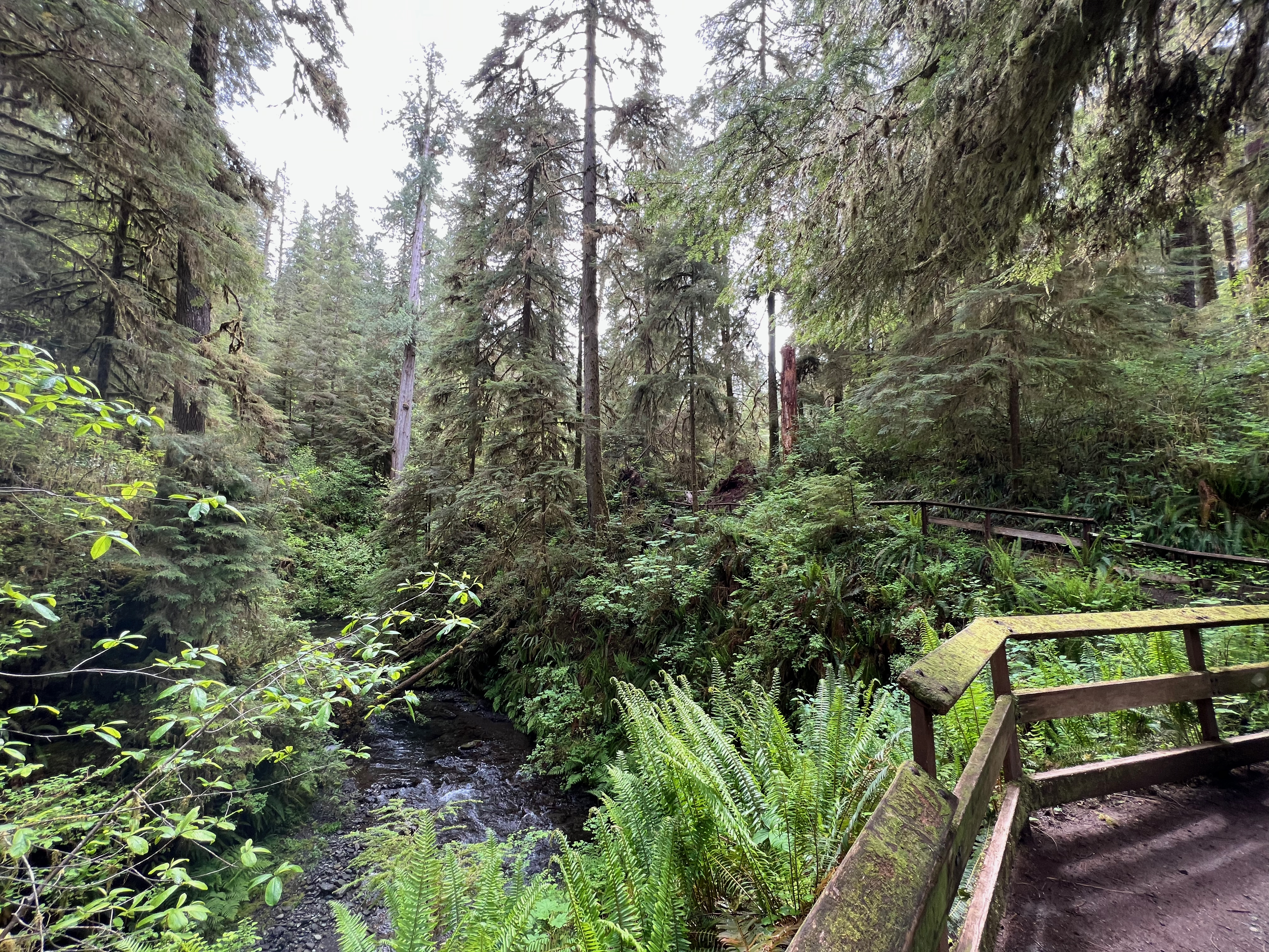
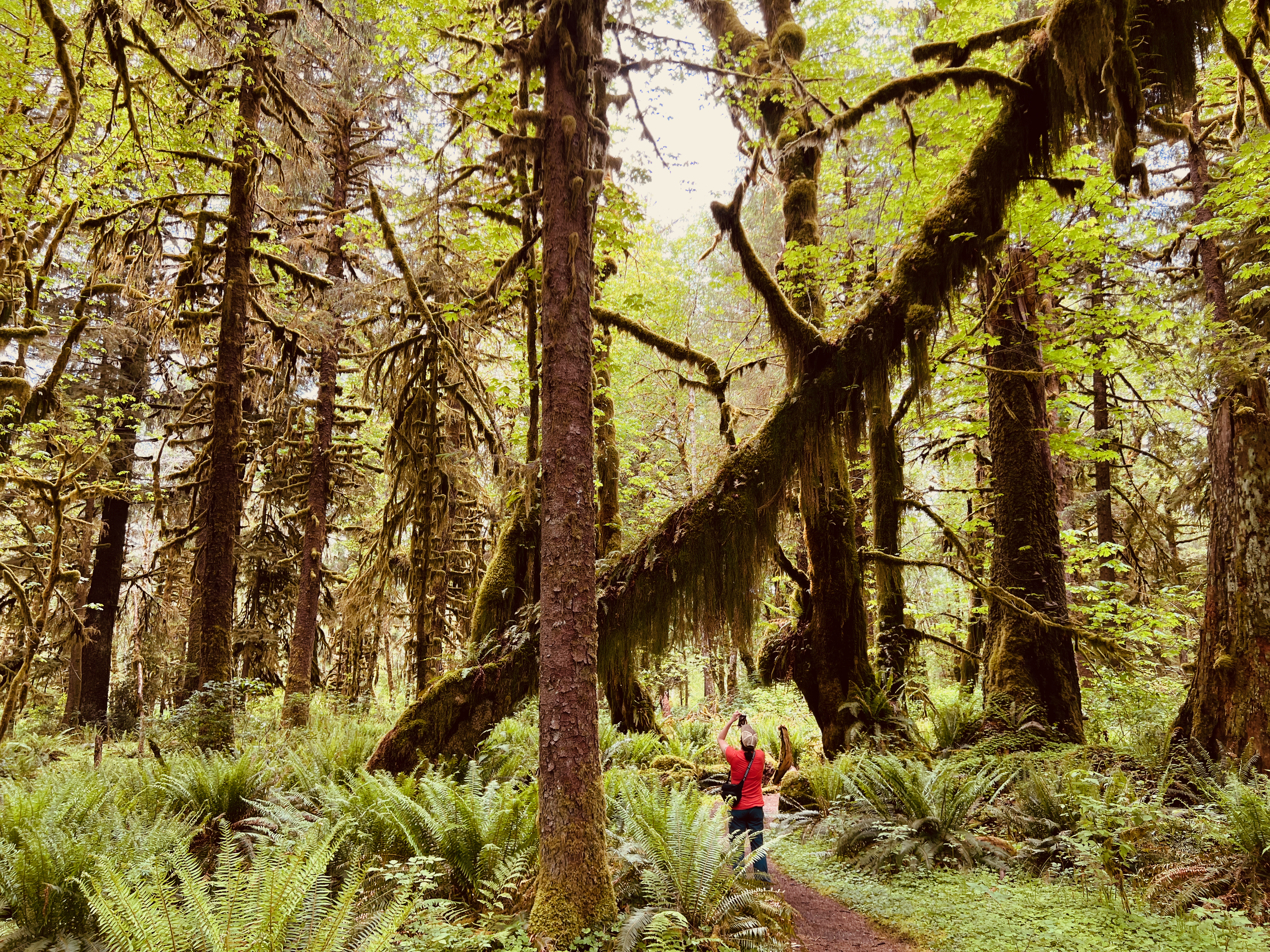
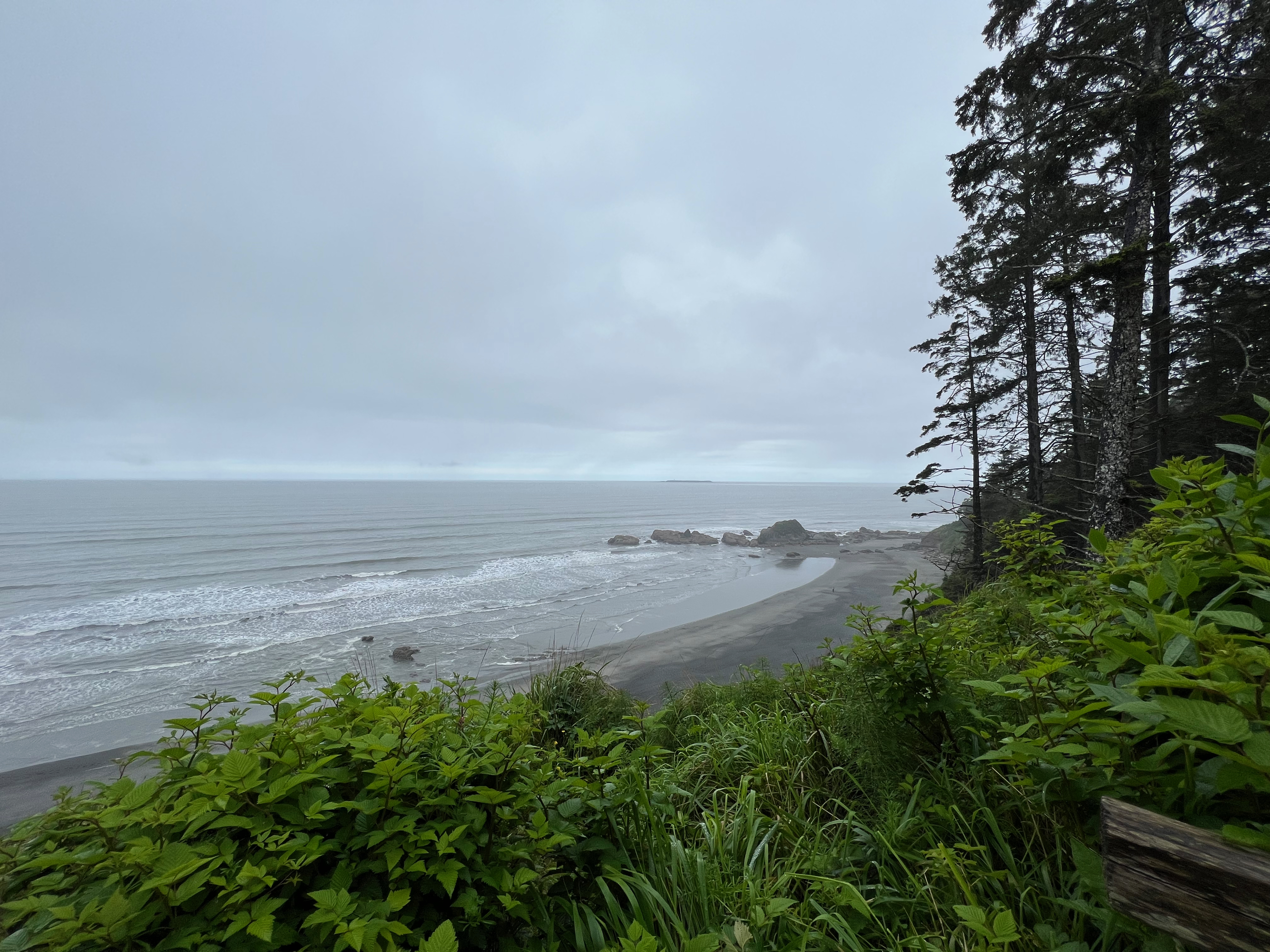
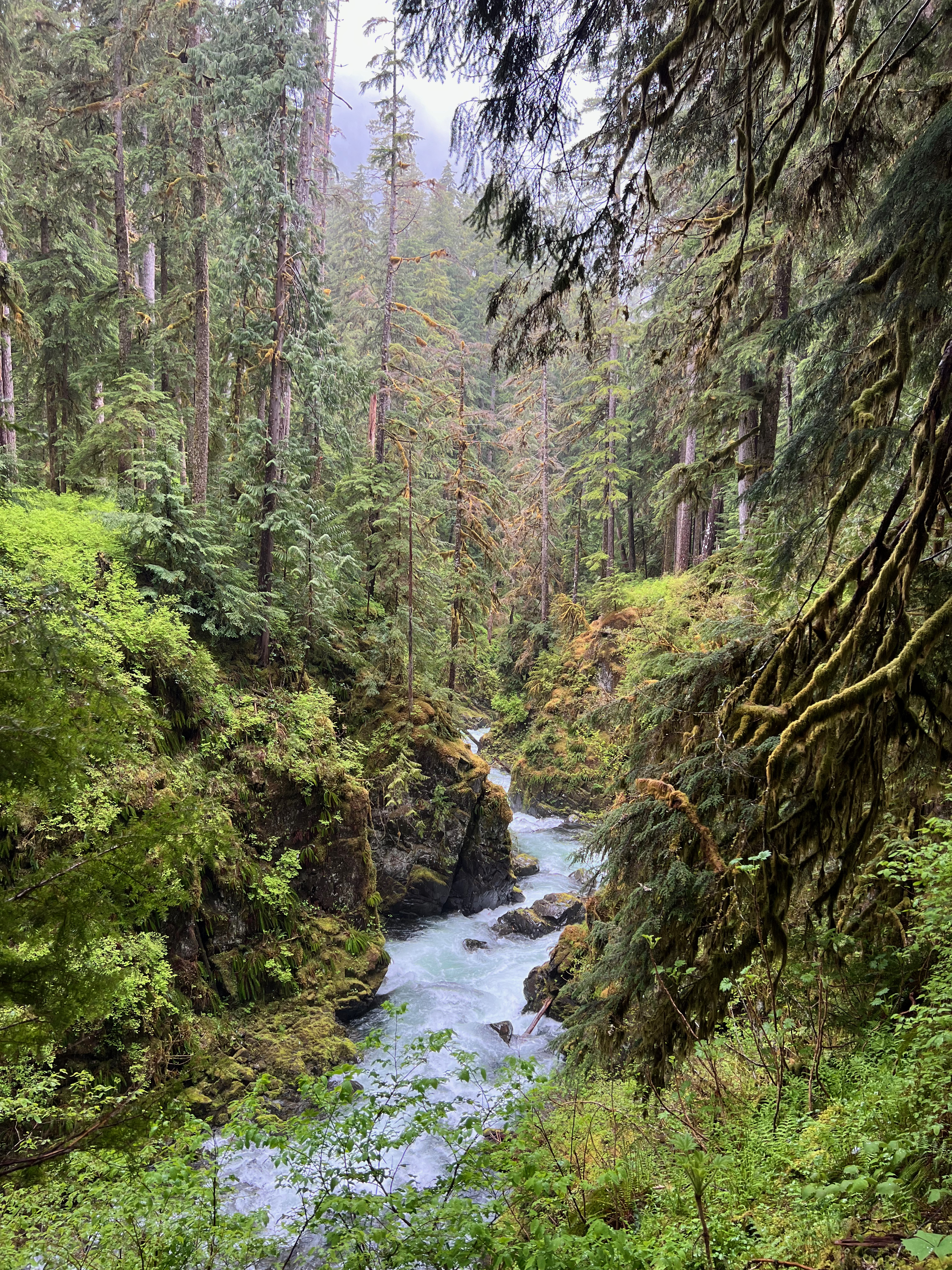
  • Every part of Olympic National Park is so different and worth seeing. If you can, build time into your itinerary to get each kind of experience: the lakes and mountains, the Pacific Coast, the rain forests, etc.
  • If you plan to stay at the Kalaloch Campgrounds (and you should!), book as early as possible for the best chance of getting one of the cliffside sites with a direct view of the ocean.
  • The National Park webcams for spots like Hurricane Ridge are a handy way to check if visibility is good or not before trekking over.
  • I’ve also found the NPS Instagram and Twitter accounts helpful for updates on parking lot wait times, road closures, and weather events.
  • I upgraded my rain jacket a year ago and was definitely glad to have a good one for this trip. Along with rain pants, weather didn’t stop us from exploring.
  • We used the app Tide Alert to check for low tide/negative tide for the day we explored tide pools.
Advertisement

Washington Road Trip: from the Peninsula to Mount Rainier

Lake Quinault

The morning is drizzly with rain, surprise. We make breakfast at camp, then head to the Rain Forest Nature trail right by our site, a short 0.5-mile trail along Willaby Creek. I hadn’t looked up anything about the trail and am blown away by the view of the Gorge and the old-growth forest flanking it on both sides. It feels like we’ve stepped into an ancient world and I almost expect a pterodactyl to swoop through the sky. The trail winds along high above creek level with a wooden railing hugging you to the side of the mountain, and I’ll continue my habit of making hyper-specific Chicagoland references by saying that it made me think of Tropic World Asia at Brookfield Zoo. Even more surprisingly, we barely see anyone else out on the trail, a stark difference from the packed parking lot at Hoh the previous day. Since the trail is so short, we join the Quinault River Trail for a bit to get a little more time in at this beautiful spot.

Rain Forest Nature Trail

Kurt and I both love a scenic drive, so we embark on the Quinault Rain Forest Loop, a 31-mile route around the entire lake. It takes about 2 hours to complete due to gravel roads and stopping to see all the waterfalls. It is also popular with bicyclists, and we see quite a few out and about. Kurt and I make a few stops at trailheads to stretch our legs on some easy hikes, including the Maple Glade Trail, which ends up being one of Kurt’s favorites. The mile-long trail takes us through a grove of ancient towering maples; I am in awe of trees and their resilience to survive centuries of extreme elements. I’ve always felt that nature is more than a little but supernatural.

Maple Glade Trail

Back in the van, the road takes us into a thick forest surrounding us on both side. This area seems prime for elk sighting, so Kurt slows the Kung Fu to a crawl and we scour the trees with our eyes. Within minutes, we spot the backs of two female elk grazing deep into the woods. The forest eventually opens up into the Quinault River valley, with a peek of snowcapped mountains in the distance. If you’re planning a trip to Olympic National Park, I’d recommend setting aside a full day for exploring the Quinault area; it’s pretty magical.

Kung Fu and the Quinault River

Once we’ve finished the Loop Drive, we say a wistful goodbye to the Olympic Peninsula. Our next destination is Mount Rainier National Park, and we have a three-hour drive ahead of us to reach Packwood, where we’ve reserved an Airbnb for the night. I’m eager for my first shower in days and a chance to wash our dirty laundry. Fueled by gas station corn dogs, we forge on to Packwood.

Packwood/ Mount Rainier/ Enumclaw

I wake up in our A-frame cabin in Packwood as the early sunlight streams into the loft sleeping area. Waking up in a real bed feels pretty great, and Kurt and I both have a pile of freshly cleaned and folded camping clothes sitting atop our bags, ready for the second half of our trip. The cabin is my dream house—rustic and cozy with a wooden deck overlooking a babbling stream. We’d sat outside the previous night eating carryout pizza and drinking canned white wine while our clothes tumbled clean in the washing machine.

Packwood cabin

This day should be interesting; as we spent last night researching trails in Mt. Rainier using the cabin’s wifi, we learned that most of the park is currently closed due to late-season snowpack. Out of our planned stops, there are only a few trailheads we can access right now. We’ll figure it out as we go. But first, coffee and breakfast tacos.

“You know of the closures?” the Ranger asks us as we enter the National Park. Yep, we tell her, we’re headed to Silver Falls, one of the few accessible trails. She nods and offers us a park map.

The Silver Falls Trail is a 4-mile loop with 705 ft of elevation gain—a moderate hike that would’ve been no big deal for me a few months ago, but more challenging than all of the short, flat hikes we’ve been doing all week. I’ve been feeling better lately, so we pack up a daypack with water, snacks, and rain jackets, and set out.

Silver Falls

Silver Falls turns out to be a pretty large, roaring waterfall, and the trail leads us across the river via footbridge twice before ascending up the ridge, into the woods, then back down. It takes about two hours for us to finish and end up back at the van. Where to next? The nearby Grove of the Patriarchs (ancient four-stories-tall Douglas firs, hemlocks, and red cedars) is temporarily closed due to the bridge being washed out. Both the route to Paradise and the road past the Sunrise entrances are closed. We get into the van and take the road up the eastern side of the park, hoping to at least catch some good views of Mount Rainier, but a thick fog settles in. As the road winds up into higher elevations, snowbanks appear, then grow in size up to what looks like over six feet high. From what locals have told us, this is highly unusual for June.

Mount Rainier National Park

The road eventually deposits us on the north side of the park, not far from our reserved campsite. We pull over and check our phones for options. Kurt finds a recommendation for a good view of Mount Rainier, sixteen miles up a forestry road. I’m antsy to do something so I say yes, but once we’ve begun rambling our way up the potholed, washboard-riddled gravel road, my anxiety spikes. I get pretty extreme acrophobia on any steep trails or roads with sheer drop-offs (see my previous blogs from the Smoky Mountains, Iceland, the Grand Canyon, Alaska, Montana, New Mexico, basically everywhere). We’re a few miles from the top when we come around a corner and see that the road ahead is covered with snow for the remainder of the way. At this point, I pretty much have a panic attack and ask Kurt to take us back down. He has to turn the van around carefully on the narrow road while I squeeze my eyes shut.

It’s now raining steadily and visibility is poor. We decide to hit up another trail, the Snoquera Falls Loop. It’s 3.9 miles with 975 feet of elevation gain, similar to our early hike but a little steeper. This is going to be a lot for me but I can always quit, as I just proved. Normalize quitting all the time!

We’ve barely gotten into the forest before we spot a big cat poo; there are signs warning of cougars in the area. So that’s exciting. The trail starts heading uphill pretty quickly, giving us a view of the forest floor. The ground is wet but thankfully not slippery, as the trail is on the narrow side, hugging the side of the ridge. I start feeling not great—lightheaded, tired. We stand in the middle of the trail as I chow down two chocolate almond butter bars and a bottle of water. I focus on breathing. After a few minutes, I tell Kurt I’m OK to keep going. The trail continues to climb via switchback, and I take a few more breaks to catch my breath. Finally, we can hear the sound of water. The initial view of Snoquera Falls after coming around the rocky corner is pretty stunning. There’s also an incredible outward-facing view of the mountains through the mist. I’m relieved to have made it.

thumbs up for not dying!

The online trail guide says you can either cross the falls and continue on the loop or turn back and come down the way you came. I’m in no mood for a scramble over wet rocks, so we turn around. Thankfully, the downhill trip is much easier for me than the uphill.

We pull into the Silver Springs campgrounds (yes, I had Fleetwood Mac in my head the whole time), which are half-empty, a stark difference from the fully booked sites in Olympic. Our site is directly next to the rushing White River. It’s a gorgeous view but unfortunately, we don’t get to sit outside and enjoy it very much, as it’s gushing rain. Kurt and I sit inside the Kung Fu at the table and have an indoor dinner and cocktail hour. We even figure out a way to convert the table to a bed without having to open the doors (mostly consisting of me tucking myself into the front seat hugging the cushions until handing them back to Kurt to put back onto the opened wood platform. We spend our last night of van camping listening to the rain and the river.

Washington Road Trip: the Pacific Coast

Forks/ Beach 4/ Kalaloch Beach

I’m so excited for this day; we basically built our entire route around the only availability to stay in the Kalaloch Beach campgrounds (advice: book your ONP campsites as early as possible!). We get started on our day after having a quick breakfast of eggs and bacon prepared on the propane stove. The goal is to reach the Pacific coast early so we have plenty of time to make it to the beach just before low tide to see the tide pools.

On the way, we pass through the town of Forks, the setting of the Twilight books. I see a storefront or two full of Twilight merch and multiple Trump MAGA signs. For the Twihards out there, two versions of Bella’s truck (book version and movie version) are parked in front of the Forks visitors’ center.

Rain pelts us as we reach the coast. The first glimpses of the Pacific Ocean through the trees are slate gray, nearly indistinguishable from the cloudy skies. At the Kalaloch ranger station, the ranger on duty recommends either Ruby Beach or Beach 4 for tide pools, with the latter being less crowded, so we park at the Beach 4 trailhead and put on our rain jackets. 

Beach 4

There’s a mist hanging over the beach which makes the tall shoreline pines and rock formations look like distant ghosts. I love it. Moody misty ocean fog appeals to my Scandinavian side. Sunshine is overrated; gimme some melancholy atmosphere. Kurt and I walk across the rocky shore to join other visitors exploring the tide pools. I climb carefully over the barnacle-covered rocks, peering into entire ecosystems flourishing in hidden nooks of the rocks. It smells like saltwater, fish, and seaweed, and I wish I could somehow bottle it up and bring it home. As we explore and find starfish, crabs, and sea anemones, the light rain stops and the sun peeps out. I take off my rain jacket, then my fleece; it becomes a warm, bright day. I spot two bald eagles gliding slow and lazy by the tree line; one of them flies in low and it’s maybe the closest I’ve ever seen one in flight.

Tide pools

From Beach 4, we head down the road to Kalaloch Beach, where our campground is located. Our camper van associate told us this was her favorite camping spot, and upon arrival, I understand why. The outermost loop of sites look out onto a cliff with a panoramic view of the ocean. Below on the dog-friendly beach, people play with their dogs in the sand. From the campground, there’s a short inclined path straight to the beach. It deposits us onto the sand not far from the Tree of Life, or Tree Root Cave, a popular spot on Kalaloch. An ancient Sitka Spruce hangs between a gap in the cliff nearly in midair, its roots exposed after erosion washed the soil away, and somehow manages to continue thriving. It’s a living metaphor, a miracle of nature, an Instagram moment, all of the above. We watch a large family swarm around the cave, multiple kids dangling from the spruce’s exposed roots, and two adults climb up the trunk all the way into the branches as I wince (the Park system discourages visitors from hanging onto the delicate roots, given the tree’s fragility). The more I travel, the more I am struck by the difference in people who see the world as their personal property or jungle gym, vs. those who lead with respect and err on the side of preservation.

Tree of Life

It’s turned into a gorgeous sunny day, so Kurt and I bring our lunch down to the beach. We spend the afternoon walking along the water looking for sand dollars and wading shin-deep. There’s a few brave souls full-on swimming in the cold water. Further down the beach, the shore turns into what Kurt calls a mass crab graveyard, the sand covered in thousands of pieces of washed-up crab legs and shells. 

At sunset, we return to the beach to watch the sun disappear into the Pacific Ocean. A small crowd has gathered, some of them camped out on chairs. I’m grateful for the clear sky and the amazing view. I think about the other sunsets we watched earlier this year in two other National Parks, Petrified Forest and Grand Canyon, and reflect on how grateful I am to have accumulated these experiences. I just want to sit in this moment and enjoy it before it slips away as all moments do.

Kalaloch Beach

Washington Road Trip: Seattle to the Olympic Peninsula

Seattle

This trip arrived exactly when I needed it and when I wasn’t yet ready for it. I planned the trip—a drive through some of the National Parks of Washington—back in February, for the purpose of using the last of our 2020 airline credits.

Six weeks before our departure, my covid-free streak and my Wordle streak broke in the same week (SO RUDE). A few weeks after recovering, some of my symptoms boomeranged back—chest tightness, shortness of breath, light-headedness, and a lingering cough. So I’m a little grumpy and a lot concerned about my stamina on this trip, planned to be full of hiking and roughing it in a camper van. But I’m doing my best to roll with it, toting my meds along with me and doing regular self-check-ins on how I’m feeling.

On Saturday morning, Kurt and I kill some time doing touristy things at Pike Place Market and grab a breakfast of eggs with fried oysters and salmon, then it’s time to pick up the van. We’d love to bring our van from home, but in the interest of time, we found a place to rent a conversion van in Seattle. To our delight, our assigned camper van is a Ford Econoline nicknamed Kung Fu, custom-painted with a dragon on each side and two Koi fish swimming in a yin yang on one of the rear doors. There’s bench seating and a table that convert into a bed, and a kitchen area in the rear with a fridge, pump-operated sink, gray water storage, and a Propane grill. After a quick grocery run, it’s time to hit the road in the direction of Olympic National Park.

Sequim

We drive for a few hours in moderate rain until we cross the floating Hood Canal Bridge, officially entering the Peninsula. Our first campsite is at Sequim Bay State Park, an area known for elk turning up in peoples’ yards and a recent local political scandal involving their mayor’s vocal support of QAnon conspiracy theories (when our camper van rep told us to Google the Mayor, Kurt had hoped that the Mayor was a cat).

The campground is pretty, full of towering pine trees with a view of the bay visible through the foliage, but I’m feeling apprehensive about my first night camping while not feeling 100%. The upcoming forecast looks like a solid green mass of rain coming right at us. Kurt whips up a quick dinner of brats and green beans before the storm rolls in. After we eat, the storm still hasn’t arrived, so we walk down to the Bay and check out the view. I love the Pacific Northwest with its mix of mountains, water, coastal fog, and old-growth forests. We spot a group of seals hanging out not far from the pier. I relax a little; while I may not be myself these days, I need to remember to enjoy the little things.

Sequim Bay State Park

It gets dark out and the rain still never arrives, so we make our first campfire of the trip. I go to bed early, snuggled into the surprisingly comfortable converted bed with my book.

Port Angeles/Lake Crescent/Sol Duc

From Sequim, it’s on to Port Angeles; you may know this as the city in Twilight where Bella and her friends go for dress shopping and Italian dinner dates. We find a place called Lola’s Cafe and I am delighted to see a Filipino breakfast on the menu. I’m in heaven with my longanisa, spam, garlic rice, and giant coffee. We also get some donuts for the road from a place called Sasquatch Donuts. While walking off our breakfast, we wander over to the pier and get a brief glimpse through the fog of Canada across the Salish Sea. Kurt checks the webcam for Hurricane Ridge, one of our potential stops for the day. The visibility is close to zero, which makes going forty-five minutes out of our way to check out the mountain view a futile exercise.

Lucky for us, there’s tons of things to do instead, so we enter Olympic National Park and take a scenic drive around Lake Crescent. The hike to Marymere Falls is easy and family-friendly, which sounds good to my lungs, so we pack up a daypack and set out.

I immediately love this National Park. Every direction you turn in looks like a Bob Ross painting come to life. The early summer light that filters through the clouds and tree canopy makes everything look a little more magical. No wonder the vampires sparkle here! We make it to the viewing platform and feel the spray of the waterfall on our skin. Kurt was smart to buy those donuts and pack them into our daypack, so we choose a spot next to a babbling stream to enjoy them. My grumpiness is melting away; I love it here. I love hiking, even if I need to take it easy. We can stop for as many breaks as I need. I’ll figure out how to adapt.

Olympic National Park

There’s another waterfall nearby our reserved campsite, so we tackle that next, but as we pull into the trailhead parking lot the light drizzle has grown into heavy rain. We see a few hikers run to their vehicle in sopping wet jeans, the absolute worst. Kurt and I grab our rain pants from our bags to pair with our rain jackets. I also opt to take along a hiking pole in case the trail gets slippery. The Sol Duc Falls Trail is another easy 1.6 mile out-and-back, and judging from the parking lot, the rain has thinned out the usual crowds. We reach the falls quickly, and admire the view from the wood bridge straddling the dramatic drop-off. “This is serving Six Flags Splashwater Falls vibes,” I say to Kurt (and will say again roughly 1,000 times before the end of the trip).

We get back to the van and it’s still pouring rain. We could go to our campsite and sit in the rain, or we could go to the nearby hot springs resort (obviously a no-brainer). “You know what would be amazing in a camper van? A mud room,” I saw to Kurt as we attempt to hang up our wet rain jackets and rain pants somewhere they can air dry while not dripping all over the seats and bedding. We do a decent enough job, but this is the kind of trip where you must make peace with the fact that everything’s always going to be at least a little bit damp, from the blackout curtains to the comforter and pillows to your fleece jacket that you wear beneath your rain jacket. During the day there’s intermittent rain, and at night, condensation clings to everything inside the van.

The hot springs feel amazing. The resort consists of four pools—three of them naturally heated at temps ranging from 99 to 109 degrees, and one lap-sized pool filled with children apparently immune to freezing water. The resort is egalitarian compared to the bougie hot springs we visited near Taos earlier this year. Kids kick around in water wings in the 107-degree pool, and the concrete ground is covered with some sort of brown goopy mildew extremely slippery beneath wet feet. But still, it’s blissful to sit neck-deep in the sulphuric hot water, gazing at the misty mountain ridge in the distance; the steam feels soothing on my messed-up lungs. We strike up conversation with a woman sitting nearby who is visiting from Alaska, and have a pleasant conversation about Copper River and what it’s like to live somewhere where a bald eagle may drop a still-alive salmon into your backyard for dinner.

Back to camp and the rain has stopped, so we attempt to make a fire, but the wet wood slows down the process. After a meager little fire, we retire to the van to sleep amidst damp curtains and the sound of the Sol Duc River.

Sol Duc Falls

Asheville Road Trip: Headed Home By Way of Cave City, KY

Friday, June 4: Take Me Home, Country Roads

On our last morning in Asheville, we said goodbye to the neighborhood cat that we had bonded with on the front porch. I loved the character of our little rental home, from the stained glass art, reclaimed church pew, and rocking chairs of the front porch to the woven hammock and ivy on the patio.

We had one last breakfast in town and made a final stop at a thrift store/bar/rock ‘n roll wedding chapel that I wanted to check out. Our plan was to roughly split the 10-hour drive home over the next two days, picking a place to spend our last night somewhere along the way. It was a hot, humid day, with the temperature creeping close to 90 degrees. Each time we got back into the car, I welcomed the blast of arctic AC on my face.

It’s always a little bittersweet to point the car towards home, knowing that this is the furthest you get to go, until next time. Goodbye, Asheville! You showed us a great time, one we sorely needed. The sun climbed higher in the sky as we crossed the North Carolina border back into Tennessee. Our proximity to Gatlinburg was measurable by the increased frequency of weird billboards–“World’s Biggest Knife Shop!” “Underground Zip-Lining!” “Some sort of Pirate Show with Sexy Russian Ladies!” (we were driving fast so I may have misread that one).

As we neared Kentucky, we stopped at a gas station to refuel and begin researching a place to stop for the night. Kurt found an USACE-run campground near a lake where all the sites looked to be waterfront, which sounded promising until we learned that it was in a dry county. I wasn’t thrilled about enduring a hot sweaty final night in the tent totally sober, so we kept searching. Nearly every campground close to Mammoth Cave was booked up. It started to look like we’d have to spend the last night of our trip in a dog-friendly Holiday Inn. We kept the booking.com listing on the proverbial back burner as we got closer to Cave City, Kentucky.

With sunset approaching, it was time to make a decision. I could tell Kurt preferred the campground over a chain hotel, but was willing to go with the Holiday Inn to make me happy. This put me into decision paralysis and I couldn’t bring myself to click the booking button on the app on my phone. “Maybe we’ll find something here,” Kurt said, suddenly optimistic as we reached the heart of Cave City and started spotting motels along the highway. All of a sudden, we spotted a semi-circle of teepee-shaped structures with a big neon sign in front. It was a classic motel right out of the last midcentury, reminiscent of old Route 66.

We pulled into the parking lot and I was googling the motel when the owner spotted us and walked over. He happened to have one remaining vacancy, and dogs were allowed as long as they were friendly. River of course took this perfect opportunity to begin barking her face off at the stranger offering us shelter for the night. Before she could blow our chances, we took her out of the car to do a proper meet-and-greet, and she finally calmed down. The owner returned with the registration form so we could get checked in. As part of the check-in process, he gave us a brief historical talk about the motel. He and his wife were its newest owners as of last winter, and they were restoring each private room one by one, keeping all of the original bed frames, dressers, and furniture from the year 1937 when the motel first opened.

I am such a fanatic for vintage motels (one of the reasons why our Route 66 trip will always be near and dear to my heart). I love the way they feel like a time capsule to another time and tell us so much about the way we used to travel before airplanes became prevalent. The teepee private rooms were such a throwback to a time when America embraced kitsch and created attention-grabbing roadside attractions designed to lure in families from their wood-paneled station wagons. It was also a throwback to a time when America hadn’t heard of the phrase cultural appropriation, which the owners acknowledge and address on their website. The tradition that they hope to keep alive is that of the American road trip, and the nightly gathering of travelers in the grassy semi-circle outside where people could meet up and share their adventure tales.

Kurt and I grabbed an easy dinner at a hot dog stand where we could sit outside with River. When we got back to the motel, we settled in on the pair of adirondack chairs outside our room and cracked open a few Asheville beers. We soon got to talking to the friendly couple staying next to us, sharing stories of our trips. As the sun fully set, the motel owner brought out some bundles of wood to the big fire pit in the middle of the semi-circle. Once the fire was going, people began to take a seat at one of the nearby benches to enjoy the warmth. It’s easy to strike up conversation with strangers around a crackling fire, and we began to introduce ourselves and share our travel itineraries.

As it grew later, the parents and grandparents headed off to put kids to bed, and two women wandered over with a few cans of Truly in hand. Almost immediately, we began talking to them about classic cars and trading stories. They were from southern Indiana and we barely caught their names, but over the next few hours, we proceeded to bond over hilarious workplace horror stories, a shared love of Halloween costumes, and a few shots of Fireball. We talked about the past year and its challenges, and how we’re all not OK but trying to find our way back to something resembling normal, and by the end of the night, we’d spent over 3 hours laughing together and having a fantastic time remembering what it’s like to befriend someone new. Though we’ll never see them again, I’ll never forget meeting them and how fun that night had been. It felt like the last piece of the trip we’d needed without realizing it–a spontaneous moment of connection with people from some other place, passing through the same place during the same moment in time. It also reminded me that sometimes we’re the boost that someone else needs, and we may never know, but they’ll be forever grateful for those shared laughs.

We drove home on Saturday, reaching Chicago in the early afternoon. I think my favorite view of Chicago will forever be approaching downtown from the south side, headed north on the Dan Ryan, with the skyline laid out in a full panorama view. It reminds me of sleeping in the backseat late on the Christmas Eve nights of my childhood, headed home from our cousins’ house filled with family and noise and celebration. This view fills me with so many warm memories of return trips home.

And then, home. Time to unpack, go through the mail, water the plants, and enjoy some bourbon.

Asheville Road Trip: City Life

Wednesday, June 2: Exploring Asheville

Among the things I craved the most during lockdown, chief among them traveling, karaoke bars, and lingering in coffee shops, I really missed brunch. I don’t care if that reveals my inner “rosé all day” basicness, but come on, who doesn’t love a big plate of fluffy eggs and biscuits and bacon that you didn’t have to make yourself, paired with alcohol before that noon in a judgement-free zone? With River tagging along, we went to Sunny Point Café, a dog-friendly brunch spot. Our outdoor table was situated next to the community garden, which was a charming spot in which to enjoy our delicious Southern breakfast. If you know me in real life, you know I that I am a Midwestern woodland creature who relishes the changing of seasons and thrives in winter, but I can admit that there a lot of advantages to year-round warm weather, including the abundance of beautiful outdoor patios and beer gardens that Asheville offers.

brrrrunccchhhh

Once we stuffed ourselves full of pimiento cheese, grits, and bacon, we headed closer to the city center with no real plans for the day other than to explore, window shop, and try some local beers. We had purposely planned a trip that would be predominantly outdoors, for the dual purpose of staying covid-safe and also being able to bring River everywhere with us. At the time of our trip, most Asheville businesses required workers to wear masks, and asked any non-vaccinated patrons to wear them as well. We stopped at the Dog Door, Asheville’s official Dog Welcome Center, and got some free treats, poop bags, and a map of dog-friendly businesses. If you love dogs, craft beer, and hiking, I highly recommend visiting Asheville. After about half a day I was ready to move there and open a dog t-shirt store. Over the afternoon, River got a new space dog-themed collar, treats, squeaky toy, and flotation device to replace her old moldy one. Between Kentucky and Asheville, it’s a toss-up whether we spent more money on bourbon or dog stuff.

Beers by the French Broad River

For a “rest” day, we still did a ton of walking as we meandered around town, wandered in and out of stores, and sought out breweries on our to-do list. After some Carolina BBQ for dinner, eaten on a dog-friendly outdoor patio, we ended up at a riverfront brewery called Zillocoah, where we had a few pints at a picnic table alongside the French Broad River.

Thursday, June 3: Inadvertent Daniel Day-Lewis Appreciation Day

As I mentioned earlier, I was obsessed with the movie The Last of the Mohicans at a formative age, so when I learned that the climactic chase scene was filmed at the nearby Chimney Rock State Park, it ended up my must-see list. Anyone who’s ever traveled with me knows that this is what I’m like and I’ll go 40 minutes out of my way just to visit the donut shop from Boogie Nights, or even devote an entire day in Scotland to riding the Hogwarts Express.

We woke up early to start the 50-minute drive to Chimney Rock. I wished that we had longer than a week off, as there were so many beautiful spots and trails that we would’ve loved to check out. The area just outside the state park looked well-equipped to accommodate lots of tourists, as RV parks and souvenir stores lined the road. My personal favorite piece of art was the side of a building decorated with the silhouette of Big Foot holding up Baby from Dirty Dancing (nearby Lake Lure was the shooting location for the iconic lift practice scene).

There are 6 trails in Chimney Rock State Park, and the one on my list was the Hickory Nut Trails Fall, which took us to the base of the 404-ft-tall waterfall from The Last of the Mohicans. If you’ve seen the movie, this is where Uncas is killed and where Alice jumps off the cliffside in her grief/to escape Magua for good (sorry, no spoiler alerts for something we all read in high school). This is a very dramatic and emotional part of the film, heightened by the striking location. The trail was a quick ‘n easy 1.4 miles out and back, mostly through the woods until the view opens up to the stunning sight of the waterfall. This also marked the first warm and humid day of our trip, and my sunglasses began to fog up as I sweated through my t-shirt.

The view of the waterfall was well worth the trip. From the base, you could look up and see the sheer drop-off where the river cascades over the rock face over 28 stories above. A small traffic jam of hikers built up on the viewing platform, so we took our photos and then moved on.

Hickory Nut Falls

The state park gets its name from the 315-ft rock formation whose likeness is often used to promote North Carolina tourism. You can get to the top of Chimney Rock by either taking a 494-step staircase, or cheat and jump on an elevator built inside the mountain. Dogs were not allowed in the elevator, and River has an aversion to wood staircases (which we once learned the hard way at Starved Rock), so Kurt and I took turns waiting with her while the other rode the elevator to the top. I went first, and was delighted when the elevator doors opened to reveal a gift shop and concession stand at the 535-million-year-old rock formation (I love finding gift shops in unexpected places, with my ultimate fave being the one at the bottom of Carlsbad Cavern).

Chimney Rock

Since the Skyline Trail wasn’t going to be doable with River, we wrapped up our day at the state park and drove back towards Asheville. We decided to check out the Biltmore, the biggest house in America and former home of George Vanderbilt. I have general “eat the rich” feelings but I also love extravagant real estate porn, and the final scene of There Will be Blood was filmed in the Biltmore’s bowling alley. Hence, our day became an inadvertent Daniel Day-Lewis Acting Appreciation Day.

We bought the grounds pass to do an outdoor tour. The humidity had increased to the point that the sky felt pregnant with rain, and I started feeling a little cranky and regretful about the cost of two day passes as we joined the swarm of sweaty tourists. But then we reached the Conservatory, and my emotions did a total 180 as I discovered the Biltmore Gardens Railway. I adore model train sets, and a dream hobby of mine is to someday build my own miniature towns. The model train tracks traveled from room to room of the expansive conservatory, winding around hothouse flowers and succulents, stopping at miniature replicas of train stations and stables, and included a replica of the Biltmore itself. The elaborate display was immersive and charming and whimsical, and it gave me that kind of magical feeling of wonder that’s so hard to experience post-childhood as a cynical adult. I honestly could’ve spent an entire day in that Conservatory, watching that train go on its botanical journey.

We got through the rest of the grounds tour without getting rained on, and that same feeling of wonder continued as we walked around the outside of the estate and under the canopy made from real trees. From the back of the house, standing behind a legit turret, we took in an expansive view of the Blue Ridge Mountains. I couldn’t imagine living on the precipice of that extraordinary view; it’s gotta be nice to be disgustingly wealthy.

We capped off our day with some really good BBQ from a food truck, then embarked on our final brewery crawl of our Asheville stay. Booo, why can’t vacation last forever? Our last two beer garden stops were my two favorites: the Funkatorium, followed by Burial Brewing. At the latter, I had the joy of going up to order a pint of a Symptom of Progeny and a Portrait of Discombobulated Sanctimony. Sitting outside at the picnic table, with River curled up under the patio lights, listening to the background chatter of other patrons, I thought about how grateful I was for the return to travel. In two days in Asheville, we had gone out more than in the entire previous 14 months combined, and it felt pretty amazing.

Asheville Road Trip: Drink Local

Monday, May 31 – Tuesday, June 1, 2021: We arrive at our final destination–North Carolina

After our day on the river, a three hour drive laid ahead. We had reserved a campsite on the far eastern side of Great Smoky Mountains National Park. Kurt did most of the driving, so I DJed our road trip tunes while we soared above gorges and disappeared into long mountain tunnels. We clapped for River at the border of Tennessee (a new state for her!) and for me at the border of North Carolina (a new state for me!).

Our reserved site was in the Cataloochee campground, one of two dog-friendly campgrounds within the national park. We stopped for USDA-stamped fire-treated firewood just outside the valley, per the strictly enforced park rules, then began the nerve-wracking (for me anyway) drive up into the mountains via a narrow gravel road made up of switchback after switchback and blind curves with steep drop-offs. I am as bad a passenger as I am a nervous driver (lucky Kurt!), so he had to deal with two whining creatures in the car until we finally reached smooth pavement with two distinct lanes.

Our night in Cataloochee was mostly quiet and relaxing, as we rested our muscles by the fire after our long day of paddling. In the morning, we woke up the sounds of the other campers around us rustling around their sites, making breakfast, getting their kids ready for the day. Nearly everyone staying in this campground had a dog with them, and I enjoyed watching others play with their pups and take them out for morning walks as I sipped my coffee.

a white dog lays on a light gray oval-shaped sleeping bag, in front of a beige and orange dome-style tent set up on a gravel pad.

My favorite types of trips blend camping and outdoor exploration with experiencing a new city, and after 3 nights in a tent post-hiking and kayaking, I was ready for a shower. We packed up camp and made our way back up the winding gravel road. We had reserved an Airbnb in Asheville, only an hour away, but the checkin time wasn’t until the late afternoon due to covid cleaning protocol, so we had lots of time to fill.

When there’s plenty of time on hand, it’s nice to take the scenic route. We jumped onto the nearby Blue Ridge Parkway, a.k.a. heaven for motorcyclists. For a few leisurely hours, we drove along mountain roads that climbed up the Ridge and disappeared into dark mountain tunnels that opened up to blue sky. We pulled over at multiple scenic vistas to take photos and take in the gorgeous views, including a glimpse of the Devil’s Courthouse, a new personal fave when it comes to names of rock formations.

OK so I should mention that an ongoing part of our North Carolina trip was my constant referencing of the 1992 film The Last of the Mohicans starring Daniel Day-Lewis and directed by Michael Mann. For some reason, my friend and I were obsessed with this movie when we were in eighth grade. Though the film was set in the region that would become upstate New York, it was actually filmed in the Blue Ridge Mountains of North Carolina. In the weeks leading up to our trip, I revisited the movie and treated Kurt to countless impressions of Daniel Day-Lewis saying to Madeleine Stowe “I’m looking at you, miss.” Kurt patiently indulged me as I played the film score via Spotify multiple times over the course of the week. (If this hasn’t been enough mentions of this random 1992 movie for you, don’t worry! There’s going to be more once we get to Chimney Rock.)

After our scenic detour, we still had some time to kill so we jumped right into checking out Asheville’s brewery scene. This was the first time on our trip that we were truly rejoining civilization in a post-lockdown world, but Asheville has so many outdoor dog-friendly patios, it was a nice way to dip my toe back into going out. We started at Bhramari Brewing Company before getting our next pint and eats at Wicked Weed. Each place we went, our servers offered a fresh bowl of water for River, who lazed under our table in the shade. Asheville’s craft beer scene includes a lot of breweries specializing sour beers, a personal favorite of Kurt’s and mine.

We stocked up at the Wicked Weed bottle shop then checked into our rental house on the northern side of the city. The outdoor patio featured a hammock, where Kurt hung out to enjoy a beer while making friends with a neighborhood cat. I caught up on Mare of Easttown on the iPad while running a load of laundry so we wouldn’t smell like campfire for the city life portion of our trip.

Asheville Road Trip: Paddling Kentucky

Monday, May 31, 2021: Paddling the Cumberland River

The owner of the campground we stayed at recommended a 14-mile stretch of the Cumberland River as a perfect day trip. “I can tell you guys are experienced, so you’ll really enjoy it,” he said as he sized up the kayak and solo canoe strapped to our car. These words always make me a little nervous. What does any given person consider “experienced”? Our annual canoe trip is on a river so slow and placid that if you lost your boat, you could walk back to camp along the sandy river bottom.

We prepared our boats at the launch right on the campground, while the owner led Kurt 14 miles down the river to the takeout spot where he could park the car. I kept hearing the takeout spot referred to as Cumberland Falls Resort. Apparently the resort included a lodge so big, it would be impossible to miss.

“So, are we on the bottom of the falls?” I asked Kurt right before we pushed off. “No, we’re at the top,” he said.

“By the way,” the campground owner told us before he drove off, “when you hit that first patch of white water, keep to the left. But you guys will be fine; you’re experienced!”

“What?!” My mind immediately jumped to the image of the Great Northern Hotel located right next to the giant Snoqualmie Falls from the opening credits of Twin Peaks. “So if we miss our takeout point, we die in a giant waterfall?!” Sometimes I think I should name my travel blog The Anxious Adventurer because my mind is always calculating all the possible chances of death. I like to think that I just have a strong sense of self-preservation, but in comparison to Kurt, I am a natural worrier.

a red canoe on a green river in front of a green forest on a sunny day with a blue sky. A long-haired man wearing a purple t-shirt sits in the canoe, looking back over his shoulder at the camera. A white dog with pointy ears wearing a life vest follows his gaze.
Cumberland River trip

We started our trip, with Kurt in the solo canoe with River, and me in the kayak. The sun was out, the sky clear and blue, and the weather warmed quickly. It was a perfect day to be out on the water.

I had my waterproof speaker bungeed to the top of my kayak, and I played my favorite summer playlist of AM Gold as we floated along. The scenery was gorgeous; both sides of the river are flanked by the National Forest. The campground owner had told us that he spotted a black bear and her two cubs on the river bank the last time he went canoeing. I relaxed into the day, drinking in the sun and landscape.

The first white water appeared early on, and we remembered the instructions to stay left. As I paddled my way over, even the left side of the river looked dotted by rocks. I did my best to navigate around the largest boulders, pointing the nose of my boat towards the smoother spots between riffles where the water broke over underwater rocks. Still, I felt the sides of the boat come into contact with rocks that shifted me sideways. I straightened out just in time to see the water level drop about a foot over a ridge. I rode over it, then looked backwards for Kurt.

“That was fun!” said Kurt, while River looked skeptical in her doggie life vest.

And so went the rest of the 14 miles, alternating stretches of serene water, occasionally broken up by light white water. As I got more confident navigating the boulders, it became a lot more fun. Still, the low key anxiety in the back of my mind lingered as we got closer to the falls. I pumped Kurt for more information, asking about the accessibility of the boat launch and the speed of the current near the resort. He assured me that it was calm water and an easy takeout compared to other spots we’d paddled in the past where we’d blown past our exit. There have to be warning signs posted, I thought to myself.

I noticed as we paddled along that hardly anyone else was out on the river. We’d only seen two other groups of boaters all day, on a holiday weekend, no less. In Wisconsin, we were used to sharing the water with dozens of groups and tubing party brigades. Having the place to ourselves was awesome and just a tiny bit concerning, because again, I worry a lot. During a serene stretch of river, I heard a strange noise coming from the forest. I turned off my my music to listen, and heard it again. A loud staccato burst of noise reverberated from the woods, followed by quiet. It sounded like a woodpecker the size of a T-rex.

As we got closer to the resort, we heard more people in the woods. A friendly man setting up camping chairs on the bank with his wife shouted an entire conversation at us, politely inquiring about our day before asking if we were going to the Falls. He didn’t seem concerned or warn us about a potential death plunge, so I chalked that up to a positive. At another point, we heard a group of young people racing four-wheelers just beyond the trees, while a girl screamed her friend’s name.

“If we lived here, I’d be doing that,” said Kurt.

“I’d be the girl screaming,” I replied.

As we reached the final 180 curve that Kurt had noted as a landmark, we started keeping an eye out for the resort. It loomed ahead, just beyond a bridge. Kurt told me that the landing would be directly past the bridge on the right, so we attempted to paddle over, but things suddenly got a bit dicey. A patch of swirling water started spinning us out and away to the left. I watched Kurt and the canoe get pushed closer to the left bank, so I gave in to the inevitable and literally went with the flow. The water pushed me onto a large flat boulder and I was grounded for a brief moment, but I was able to scooch myself off and back into enough water to float me over. We got passed the eddies, and the water smoothed out all the way to the bridge. We hugged the right river bank, searching for the takeout point. From what Kurt had seen when he dropped off the car earlier, it was a clear and easy ramp, but we couldn’t see it from the vantage point of the water.

“Maybe we need to go a little bit farther?” Kurt asked, and my heart started to speed up.

“I thought you said it was right next to the bridge.” The resort was situated up the high river bank, and tons of people sauntered along the sidewalk just beyond a wooden fence. “Maybe we should ask someone.”

“Hey!” Kurt shouted to a man nearby. “Do you know if the boat ramp is nearby, or is it further down?”

“I have no idea!” he shouted back. “But you know there’s a waterfall coming up?”

“Exactly my concern!” I replied, grimacing.

A group of ducks floated just ahead of us, and we noticed that they disappeared behind some tall grass along the bank. Aha! We paddled closer, and finally spotted the gradual dirt ramp emerging from the water that had been hidden behind the grass. I sped up, paddling my way to solid ground with relief.

Once we’d dealt with strapping both boats back onto the car, we took a walk further downriver to check out the waters. A Memorial Day crowd packed the parking lot and sidewalks, and dozens of motorcycles slow-rolled past while looking for spots. We passed the gift shop and concessions to make our way to the viewing platform, and finally saw the Cumberland Falls–all 70 feet of it, just under 200 yards away from where we took out our boats. My anxiety rests its case.

Cumberland Falls

Asheville Road Trip: Hiking Kentucky

Sunday, May 30: Hiking the National Forest

A plate of bacon, potatoes, and eggs sitting on a lap, while a white dog stands next to it begging for a bite.
“Are you gonna finish that?”

The weather forecast for the day topped out in the low 60s, a little on the chilly side for paddling but perfect for hiking. Kurt and the campground owner had talked about some trail recommendations the previous night, so we opted for one that sounded good despite its name, the Dog Slaughter Falls Trail. I do not know the history of this waterfall’s name, but by the end of our week of traveling through the rural South, I grew accustomed to places named after various creatures, varmints, and their untimely demise. There’s two trailheads, locally referred to as the old one and the new one, and we went with the latter in order to maximize our hike further onto the adjoining Sheltowee Trail (the older trailhead adds a few more miles of walking alongside the road and Dog Slaughter Creek).

The National Forest was busy on Memorial Day weekend, and we passed lots of families and couples, many of them out with their dogs. Dog Slaughter Trail is rated easy to moderate, with just enough climbing to keep the views interesting. There were enough thick roots and large boulders that I was glad I had my hiking poles, and I can imagine that on a muddy day, some areas would get especially dicey, but we lucked out with perfect hiking weather conditions. River was a hit on the trail, with every passing child asking if they could pet her. When she went into dog Parkour mode over some of the larger boulders, passersby cheered for her.

We settled into our hiking rhythm, and it felt amazing to be stretching our legs on the trail. After a year spent confined to the Midwest, I relished the change of scenery. There’s something so elemental and uncomplicated about experiencing a place via hiking. At a walking pace, you notice the tiniest details, the scent of different kinds of forests, even the feeling of the air, from the dry high altitudes of New Mexico to the salty mist of Maine. In Kentucky, there was a light scent of hemlock and hickory. The air temperatures lingered on the edge of spring dipping into early summer.

As we grew closer to the waterfall, we noticed the sound of rushing water drifted through the trees. The trail takes you up a ridge high above the creek before descending down some meandering switchbacks to the base of the falls. Nestled into a woodsy cove, the waterfall is much more pleasant than its name suggests. Hikers rested on the rocks, eating snacks and snapping photos. Some kids crawled along the rocks behind the falls to stand hidden by the spray. We witnessed a girl show up with a photographer and an outfit change to take a sweet 16 photo shoot in the scenic spot.

a 20-foot-tall waterfall cascades from a sheer drop into a small pool.
Dog Slaughter Falls
A female hiker poses in front a large rock formation multiple stories tall.
Hiking the trail

After a snack break, Kurt, River, and I continued past the waterfall towards the Sheltowee Trail, and found ourselves alone in the forest. It seemed to be the popular choice for over 90% of hikers to turn around at the waterfall instead of doing the entire 2.4 mile in-and-out trail. Once we merged onto the Sheltowee, the trail runs alongside the much wider Cumberland River. I could tell we were the first ones on the trail that day as I walked through a LOT of spiderwebs. Since we planned to paddle the Cumberland River the following day, we looked for gaps in the trees to get a better view. Eventually, we found a sandy path down the ridge that took us right to the water’s edge. The current turned into light white water as it broke up over scattered boulders. We found a nice spot along the water to chill out for a while and play stick fetch with River. The spot had the remains of a fire pit and some sitting logs, so it must have been recently used by backpackers. I’d absolutely come back to this National Forest for a backpacking trip someday.

A wide river flanked by green trees and boulders. In the foreground, a long-haired man in a long-sleeved shirt and pants sits on the rocks, smiling, next to a white medium-sized dog.
Kurt and River alongside the Cumberland River

We turned around to make the return trip back to our car. Once again, we were alone on the Sheltowee (besides a trail runner talking to his GoPro), and the crowds returned when we reached the falls. River scrambled over the boulders like a champ. Part of the reason we really wanted to bring River on this trip is because she turned 9 years old last winter, but she still has great energy and drive to explore. We want to get in as many adventure trips as we can with her while she’s still up for it. Despite the dog-unfriendly name, the waterfall and trail were the perfect difficulty level for a senior adventure dog.

After leaving the forest, we took a longer route back to our campsite, detouring through a small town for treats. At a Dairy Queen drive-in, River was given her own pup-cup of soft serve ice cream. We ate our ice cream on the patio while watching a pack of bikers pass through, likely on their way to the Smokies. Whenever we travel, I always get a little wistful over the idea of living somewhere so close to the mountains.

After one final stop for treats (a.k.a. the Bourbon Barn), we headed back to camp. Kurt cooked burgers for dinner, which we paired with a 6-pack of local beers. We rested our legs by the fire before bundling up for a chilly night in the tent.

Asheville Road Trip: Indiana and Kentucky

Friday, May 28, 2021: IL – IN

I can’t keep track of how many trips we’ve canceled or postponed since March 2020. Leading into the departure date of our Southern road trip, when friends asked me if I was excited, I typically responded “I still won’t believe we’re going until we cross our first state line.” As I started packing my clothes, I felt like I’d forgotten all of my usual techniques and was forgetting half of my necessities.

Kurt and I finished work on a Friday afternoon, then began packing the car, and that felt slow-going and strange as well. It took two hours to get our gear loaded, then strap the canoe and kayak to the rack, as we searched the house for a misplaced bag of ropes. We locked up the house, loaded our dog River then ourselves into the Subaru, got on the expressway…then sat in gridlock traffic in the pouring rain for two more hours. Vacation!!!

Then finally, the road opened up, the rain lightened, and we stretched our cramped and atrophied wanderlusting souls across the Indiana landscape as we flew through a field of wind turbines, their red lights blinking in unison at us like an affirmation. Believe me, no one has romanticized the state of Indiana more than I did in that moment.* This past year has been a LOT, on the global and personal level, and I needed to do something again that helped me remember my true self, and that thing was eating a Wendy’s chicken sandwich off my lap while traveling 75 miles per hour.

We reached our hotel in southern Indiana just before midnight. We had a pet-friendly room, and River was overwhelmed by all of the smells of her first hotel stay (she could not stop zig-zagging to new spots on the carpet, which only made me more suspect of how gross this place must be). The artwork in our room had an addendum left by a recent guest, who scribbled “Legalize it” in paint pen across the bottom of a pastel landscape. Ah, vacation. I’m so happy to finally be here.

*maybe John Cougar Mellencamp

Saturday, May 29, 2021: IN – KY

After we crossed the state border into Kentucky, a light rain returned and the temperature hovered in the high 40s. We sailed through Louisville early, making our way towards our planned destination for the next few days, Daniel Boone National Forest. But first, we needed to make at least one stop on the Bourbon Trail. As we traveled down a windy road lined by horse farms, I queued up Elvis Presley’s “In the Cold Kentucky Rain” on Spotify. Kurt and I took turns checking out the gift shop and exploring the picturesque grounds with River. We noticed that the tasting line died down, so we wandered over for a midday bourbon cocktail, as one does. The bartender provided River with some dog treats and a copper dog bowl to match our Kentucky Mule and Classic Old Fashioned.

A white dog with pointy ears sits in front a brown wood barrel on a wood porch. The name "Woodford Reserve" appears on the side of the barrel.

After putting some BBQ in our bellies, we continued southeast. Watching the landscape rush by my window, I loved how even the trees look different whenever I visit a region outside the Midwest. The road curved around mountains and across bridges spanning river gorges. When we reached our destination, the familiar ’60s-style brown and yellow National Forest sign greeted us. Vacation was really truly happening.

We drove up and down gravel forestry roads looking for a good spot to do some dispersed camping for the night, but as the sun grew low and the best-looking options had already been claimed, we pulled over to the side of the road to regroup. Not one, but two cars pulled up next to us to see if we needed any help; people are definitely friendly around here. I found a nearby primitive site on private land on HipCamp.com, so we booked it and headed over. We drove along winding country roads until we reached the Kentucky barn described in the listing. The property owner greeted us then led the way to the site on his John Deere, checking with us first to make sure we had all-wheel drive. He guided us to a forest clearing at the top of a hill at the end of a long private road, complete with a fire ring and picnic table, all we needed. Surrounded by thick trees and with the nearest site way down at the foot of the hill, we had total privacy.

I stepped into my usual job of setting up the tent and unrolling our bedding, while Kurt prepped his outdoor kitchen and started a campfire. After our dinner of chicken burritos, a light sprinkling of rain returned–not enough to send us into the tent, but just enough to block out the stars. We stayed by the campfire drinking wine for a while longer until eventually calling it a night. I cuddled into my sleeping bag, listening to the soft rain and the moo of nearby cows, looking forward to a week of adventures. I just hoped I got all the ticks off of River first.

A camping scene: In the foreground, there is a campfire with two folding chairs set up nearby. In the background, a gray and orange domed tent is set up in front of a Subaru with a kayak strapped to the roof rack. On the right, a man stands over a picnic table cooking on a portable stovetop.