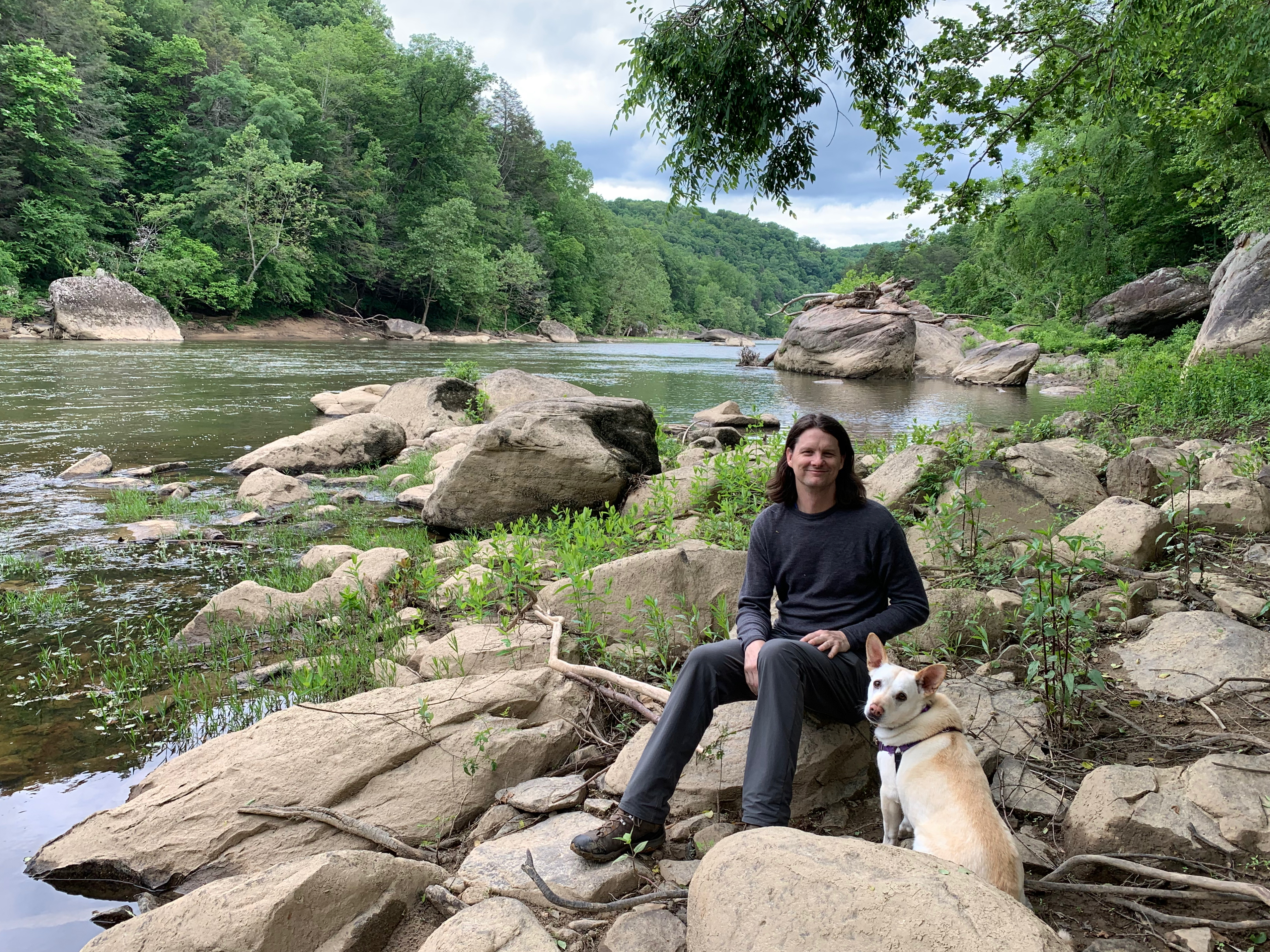
Washington Road Trip: from the Peninsula to Mount Rainier

Lake Quinault

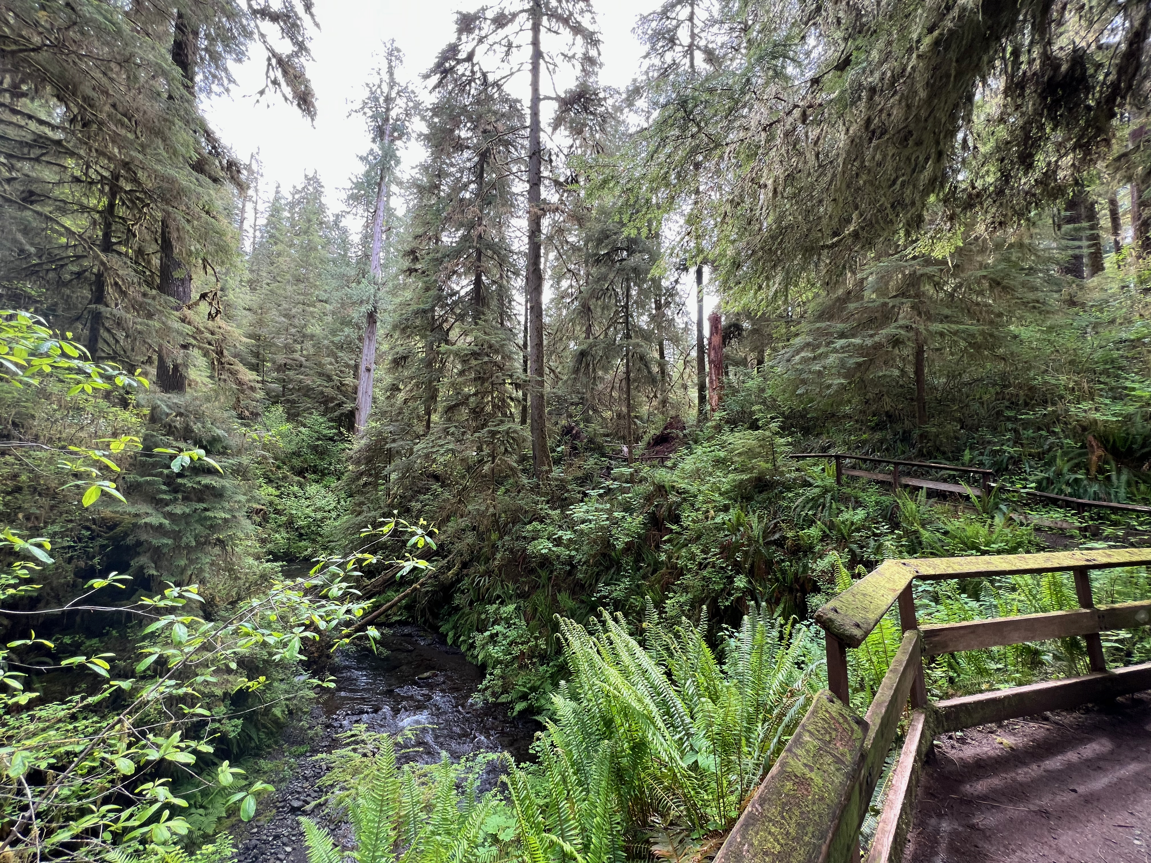
The morning is drizzly with rain, surprise. We make breakfast at camp, then head to the Rain Forest Nature trail right by our site, a short 0.5-mile trail along Willaby Creek. I hadn’t looked up anything about the trail and am blown away by the view of the Gorge and the old-growth forest flanking it on both sides. It feels like we’ve stepped into an ancient world and I almost expect a pterodactyl to swoop through the sky. The trail winds along high above creek level with a wooden railing hugging you to the side of the mountain, and I’ll continue my habit of making hyper-specific Chicagoland references by saying that it made me think of Tropic World Asia at Brookfield Zoo. Even more surprisingly, we barely see anyone else out on the trail, a stark difference from the packed parking lot at Hoh the previous day. Since the trail is so short, we join the Quinault River Trail for a bit to get a little more time in at this beautiful spot.

Rain Forest Nature Trail

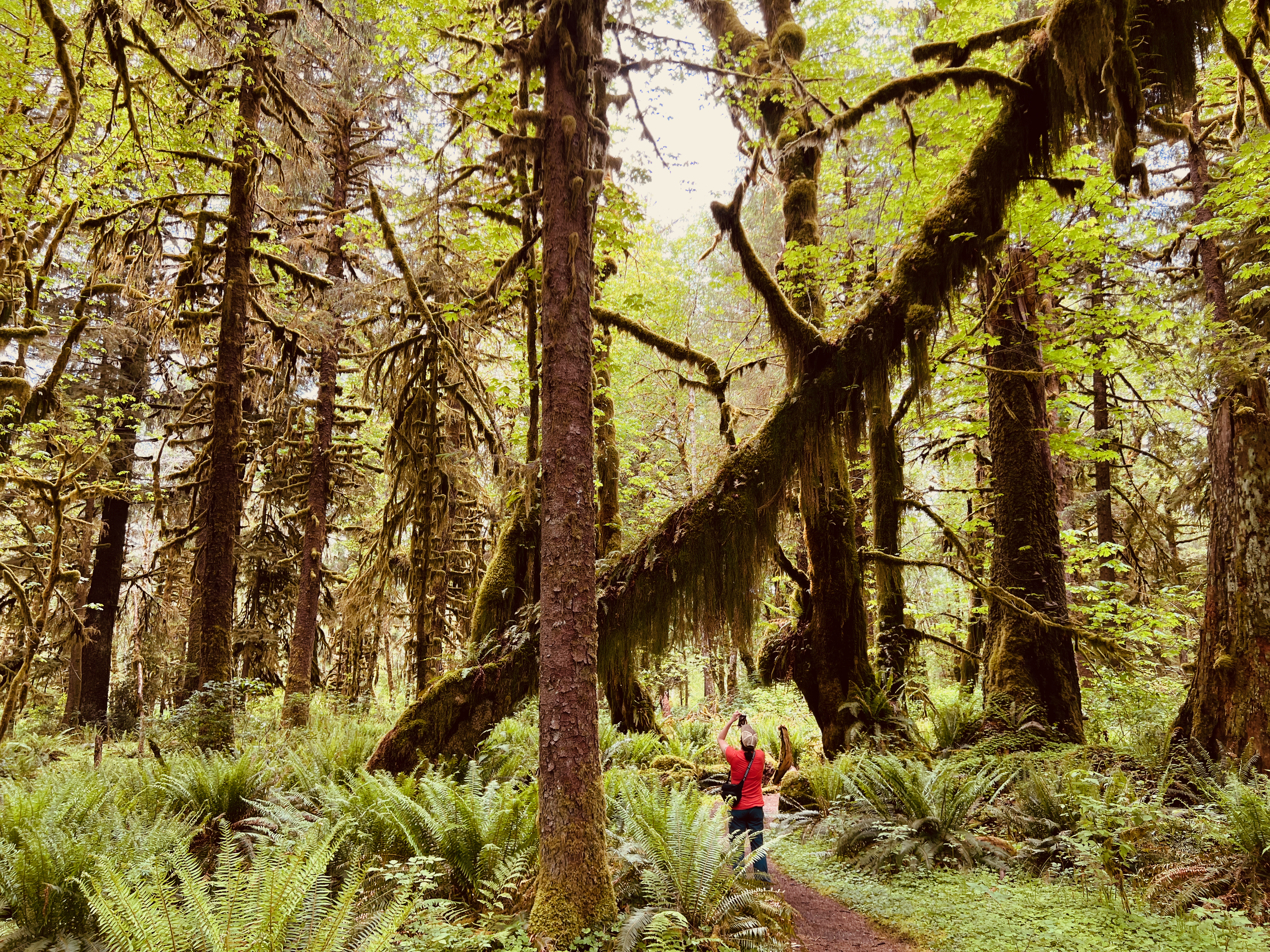
Kurt and I both love a scenic drive, so we embark on the Quinault Rain Forest Loop, a 31-mile route around the entire lake. It takes about 2 hours to complete due to gravel roads and stopping to see all the waterfalls. It is also popular with bicyclists, and we see quite a few out and about. Kurt and I make a few stops at trailheads to stretch our legs on some easy hikes, including the Maple Glade Trail, which ends up being one of Kurt’s favorites. The mile-long trail takes us through a grove of ancient towering maples; I am in awe of trees and their resilience to survive centuries of extreme elements. I’ve always felt that nature is more than a little but supernatural.

Maple Glade Trail

Back in the van, the road takes us into a thick forest surrounding us on both side. This area seems prime for elk sighting, so Kurt slows the Kung Fu to a crawl and we scour the trees with our eyes. Within minutes, we spot the backs of two female elk grazing deep into the woods. The forest eventually opens up into the Quinault River valley, with a peek of snowcapped mountains in the distance. If you’re planning a trip to Olympic National Park, I’d recommend setting aside a full day for exploring the Quinault area; it’s pretty magical.

Kung Fu and the Quinault River

Once we’ve finished the Loop Drive, we say a wistful goodbye to the Olympic Peninsula. Our next destination is Mount Rainier National Park, and we have a three-hour drive ahead of us to reach Packwood, where we’ve reserved an Airbnb for the night. I’m eager for my first shower in days and a chance to wash our dirty laundry. Fueled by gas station corn dogs, we forge on to Packwood.

Packwood/ Mount Rainier/ Enumclaw

I wake up in our A-frame cabin in Packwood as the early sunlight streams into the loft sleeping area. Waking up in a real bed feels pretty great, and Kurt and I both have a pile of freshly cleaned and folded camping clothes sitting atop our bags, ready for the second half of our trip. The cabin is my dream house—rustic and cozy with a wooden deck overlooking a babbling stream. We’d sat outside the previous night eating carryout pizza and drinking canned white wine while our clothes tumbled clean in the washing machine.

Packwood cabin

This day should be interesting; as we spent last night researching trails in Mt. Rainier using the cabin’s wifi, we learned that most of the park is currently closed due to late-season snowpack. Out of our planned stops, there are only a few trailheads we can access right now. We’ll figure it out as we go. But first, coffee and breakfast tacos.

“You know of the closures?” the Ranger asks us as we enter the National Park. Yep, we tell her, we’re headed to Silver Falls, one of the few accessible trails. She nods and offers us a park map.

The Silver Falls Trail is a 4-mile loop with 705 ft of elevation gain—a moderate hike that would’ve been no big deal for me a few months ago, but more challenging than all of the short, flat hikes we’ve been doing all week. I’ve been feeling better lately, so we pack up a daypack with water, snacks, and rain jackets, and set out.

Silver Falls

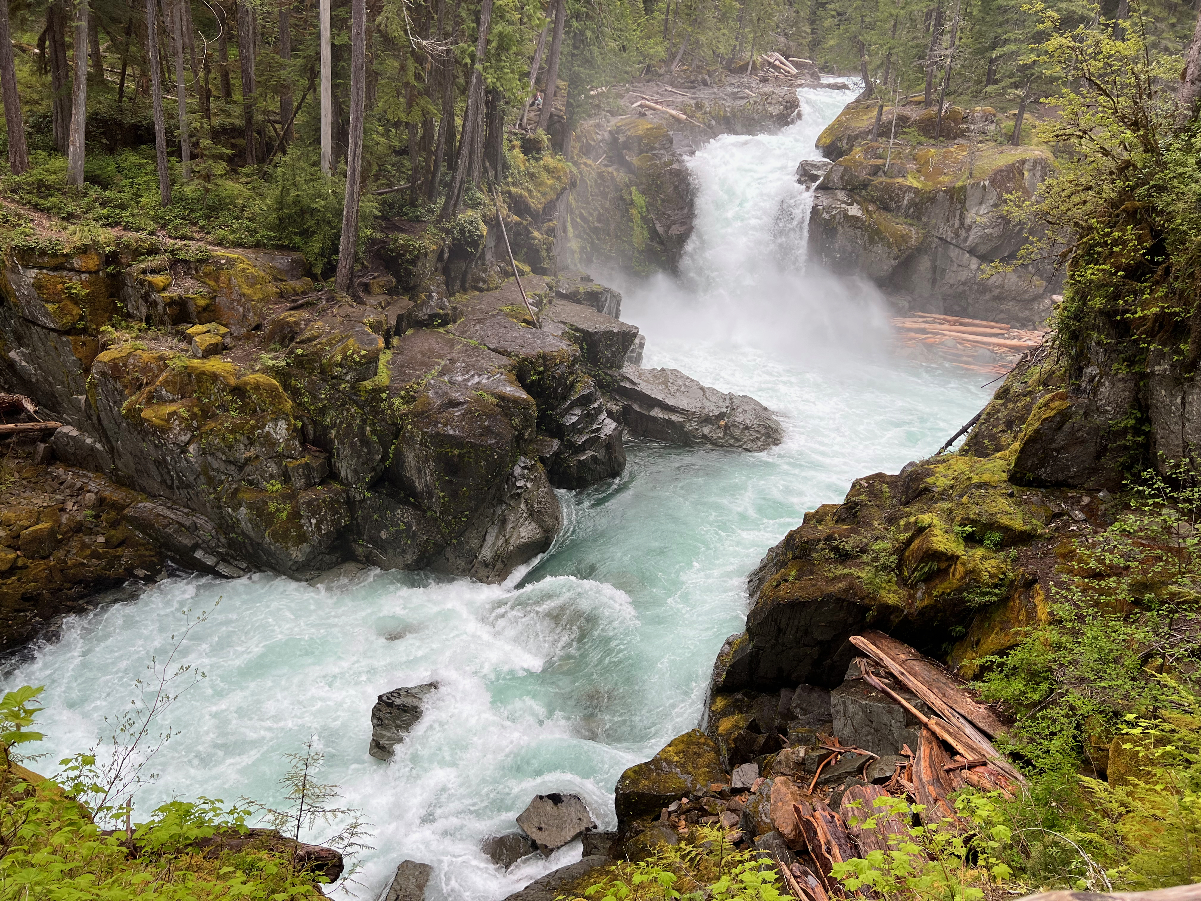
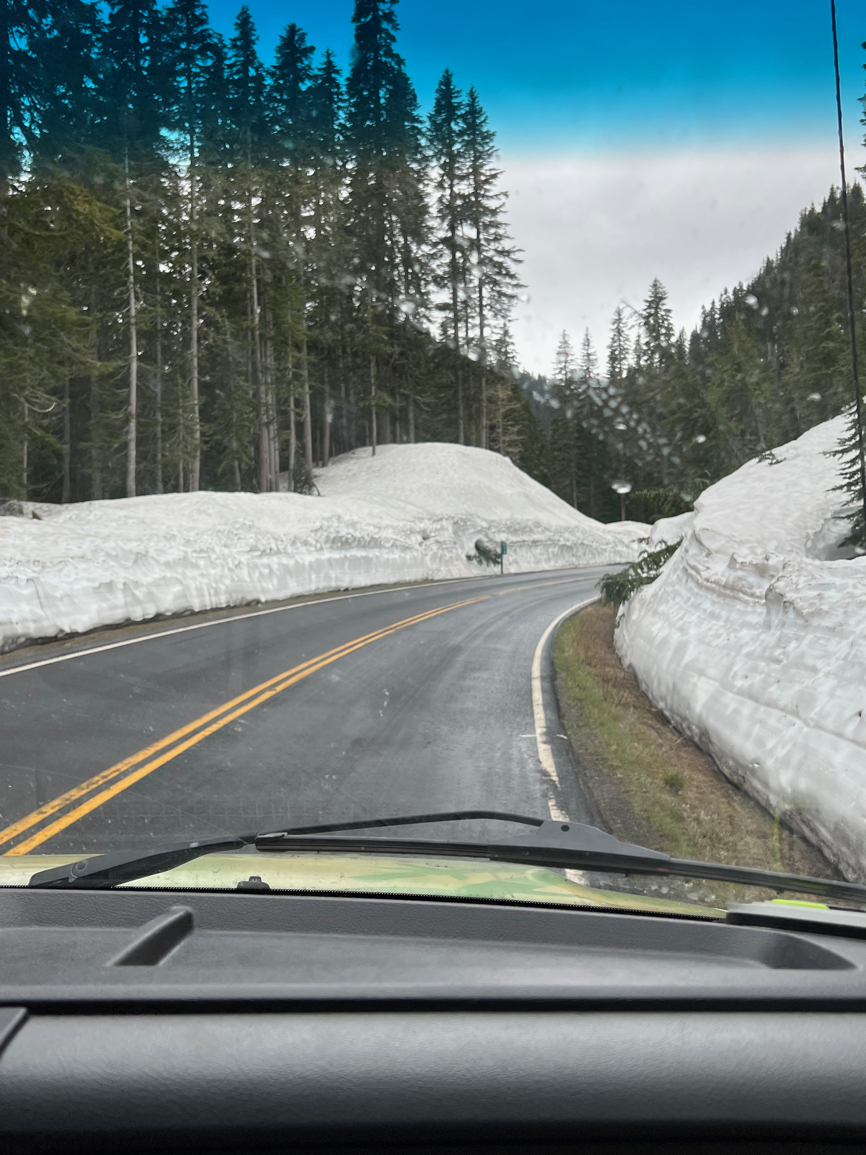
Silver Falls turns out to be a pretty large, roaring waterfall, and the trail leads us across the river via footbridge twice before ascending up the ridge, into the woods, then back down. It takes about two hours for us to finish and end up back at the van. Where to next? The nearby Grove of the Patriarchs (ancient four-stories-tall Douglas firs, hemlocks, and red cedars) is temporarily closed due to the bridge being washed out. Both the route to Paradise and the road past the Sunrise entrances are closed. We get into the van and take the road up the eastern side of the park, hoping to at least catch some good views of Mount Rainier, but a thick fog settles in. As the road winds up into higher elevations, snowbanks appear, then grow in size up to what looks like over six feet high. From what locals have told us, this is highly unusual for June.

Mount Rainier National Park

The road eventually deposits us on the north side of the park, not far from our reserved campsite. We pull over and check our phones for options. Kurt finds a recommendation for a good view of Mount Rainier, sixteen miles up a forestry road. I’m antsy to do something so I say yes, but once we’ve begun rambling our way up the potholed, washboard-riddled gravel road, my anxiety spikes. I get pretty extreme acrophobia on any steep trails or roads with sheer drop-offs (see my previous blogs from the Smoky Mountains, Iceland, the Grand Canyon, Alaska, Montana, New Mexico, basically everywhere). We’re a few miles from the top when we come around a corner and see that the road ahead is covered with snow for the remainder of the way. At this point, I pretty much have a panic attack and ask Kurt to take us back down. He has to turn the van around carefully on the narrow road while I squeeze my eyes shut.

It’s now raining steadily and visibility is poor. We decide to hit up another trail, the Snoquera Falls Loop. It’s 3.9 miles with 975 feet of elevation gain, similar to our early hike but a little steeper. This is going to be a lot for me but I can always quit, as I just proved. Normalize quitting all the time!

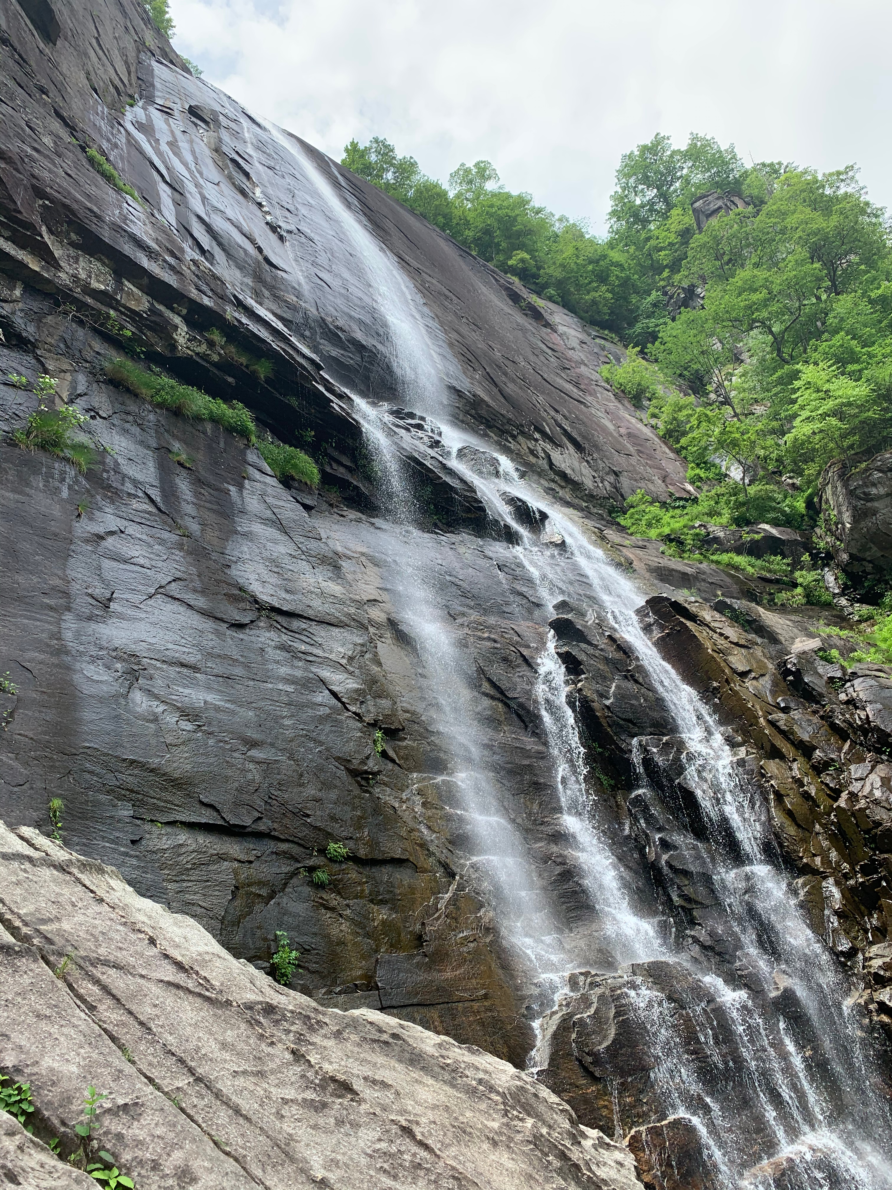
We’ve barely gotten into the forest before we spot a big cat poo; there are signs warning of cougars in the area. So that’s exciting. The trail starts heading uphill pretty quickly, giving us a view of the forest floor. The ground is wet but thankfully not slippery, as the trail is on the narrow side, hugging the side of the ridge. I start feeling not great—lightheaded, tired. We stand in the middle of the trail as I chow down two chocolate almond butter bars and a bottle of water. I focus on breathing. After a few minutes, I tell Kurt I’m OK to keep going. The trail continues to climb via switchback, and I take a few more breaks to catch my breath. Finally, we can hear the sound of water. The initial view of Snoquera Falls after coming around the rocky corner is pretty stunning. There’s also an incredible outward-facing view of the mountains through the mist. I’m relieved to have made it.

thumbs up for not dying!

The online trail guide says you can either cross the falls and continue on the loop or turn back and come down the way you came. I’m in no mood for a scramble over wet rocks, so we turn around. Thankfully, the downhill trip is much easier for me than the uphill.

We pull into the Silver Springs campgrounds (yes, I had Fleetwood Mac in my head the whole time), which are half-empty, a stark difference from the fully booked sites in Olympic. Our site is directly next to the rushing White River. It’s a gorgeous view but unfortunately, we don’t get to sit outside and enjoy it very much, as it’s gushing rain. Kurt and I sit inside the Kung Fu at the table and have an indoor dinner and cocktail hour. We even figure out a way to convert the table to a bed without having to open the doors (mostly consisting of me tucking myself into the front seat hugging the cushions until handing them back to Kurt to put back onto the opened wood platform. We spend our last night of van camping listening to the rain and the river.

Advertisement

Asheville Road Trip: City Life

Wednesday, June 2: Exploring Asheville

Among the things I craved the most during lockdown, chief among them traveling, karaoke bars, and lingering in coffee shops, I really missed brunch. I don’t care if that reveals my inner “rosé all day” basicness, but come on, who doesn’t love a big plate of fluffy eggs and biscuits and bacon that you didn’t have to make yourself, paired with alcohol before that noon in a judgement-free zone? With River tagging along, we went to Sunny Point Café, a dog-friendly brunch spot. Our outdoor table was situated next to the community garden, which was a charming spot in which to enjoy our delicious Southern breakfast. If you know me in real life, you know I that I am a Midwestern woodland creature who relishes the changing of seasons and thrives in winter, but I can admit that there a lot of advantages to year-round warm weather, including the abundance of beautiful outdoor patios and beer gardens that Asheville offers.

brrrrunccchhhh

Once we stuffed ourselves full of pimiento cheese, grits, and bacon, we headed closer to the city center with no real plans for the day other than to explore, window shop, and try some local beers. We had purposely planned a trip that would be predominantly outdoors, for the dual purpose of staying covid-safe and also being able to bring River everywhere with us. At the time of our trip, most Asheville businesses required workers to wear masks, and asked any non-vaccinated patrons to wear them as well. We stopped at the Dog Door, Asheville’s official Dog Welcome Center, and got some free treats, poop bags, and a map of dog-friendly businesses. If you love dogs, craft beer, and hiking, I highly recommend visiting Asheville. After about half a day I was ready to move there and open a dog t-shirt store. Over the afternoon, River got a new space dog-themed collar, treats, squeaky toy, and flotation device to replace her old moldy one. Between Kentucky and Asheville, it’s a toss-up whether we spent more money on bourbon or dog stuff.

Beers by the French Broad River

For a “rest” day, we still did a ton of walking as we meandered around town, wandered in and out of stores, and sought out breweries on our to-do list. After some Carolina BBQ for dinner, eaten on a dog-friendly outdoor patio, we ended up at a riverfront brewery called Zillocoah, where we had a few pints at a picnic table alongside the French Broad River.

Thursday, June 3: Inadvertent Daniel Day-Lewis Appreciation Day

As I mentioned earlier, I was obsessed with the movie The Last of the Mohicans at a formative age, so when I learned that the climactic chase scene was filmed at the nearby Chimney Rock State Park, it ended up my must-see list. Anyone who’s ever traveled with me knows that this is what I’m like and I’ll go 40 minutes out of my way just to visit the donut shop from Boogie Nights, or even devote an entire day in Scotland to riding the Hogwarts Express.

We woke up early to start the 50-minute drive to Chimney Rock. I wished that we had longer than a week off, as there were so many beautiful spots and trails that we would’ve loved to check out. The area just outside the state park looked well-equipped to accommodate lots of tourists, as RV parks and souvenir stores lined the road. My personal favorite piece of art was the side of a building decorated with the silhouette of Big Foot holding up Baby from Dirty Dancing (nearby Lake Lure was the shooting location for the iconic lift practice scene).

There are 6 trails in Chimney Rock State Park, and the one on my list was the Hickory Nut Trails Fall, which took us to the base of the 404-ft-tall waterfall from The Last of the Mohicans. If you’ve seen the movie, this is where Uncas is killed and where Alice jumps off the cliffside in her grief/to escape Magua for good (sorry, no spoiler alerts for something we all read in high school). This is a very dramatic and emotional part of the film, heightened by the striking location. The trail was a quick ‘n easy 1.4 miles out and back, mostly through the woods until the view opens up to the stunning sight of the waterfall. This also marked the first warm and humid day of our trip, and my sunglasses began to fog up as I sweated through my t-shirt.

The view of the waterfall was well worth the trip. From the base, you could look up and see the sheer drop-off where the river cascades over the rock face over 28 stories above. A small traffic jam of hikers built up on the viewing platform, so we took our photos and then moved on.

Hickory Nut Falls

The state park gets its name from the 315-ft rock formation whose likeness is often used to promote North Carolina tourism. You can get to the top of Chimney Rock by either taking a 494-step staircase, or cheat and jump on an elevator built inside the mountain. Dogs were not allowed in the elevator, and River has an aversion to wood staircases (which we once learned the hard way at Starved Rock), so Kurt and I took turns waiting with her while the other rode the elevator to the top. I went first, and was delighted when the elevator doors opened to reveal a gift shop and concession stand at the 535-million-year-old rock formation (I love finding gift shops in unexpected places, with my ultimate fave being the one at the bottom of Carlsbad Cavern).

Chimney Rock

Since the Skyline Trail wasn’t going to be doable with River, we wrapped up our day at the state park and drove back towards Asheville. We decided to check out the Biltmore, the biggest house in America and former home of George Vanderbilt. I have general “eat the rich” feelings but I also love extravagant real estate porn, and the final scene of There Will be Blood was filmed in the Biltmore’s bowling alley. Hence, our day became an inadvertent Daniel Day-Lewis Acting Appreciation Day.

We bought the grounds pass to do an outdoor tour. The humidity had increased to the point that the sky felt pregnant with rain, and I started feeling a little cranky and regretful about the cost of two day passes as we joined the swarm of sweaty tourists. But then we reached the Conservatory, and my emotions did a total 180 as I discovered the Biltmore Gardens Railway. I adore model train sets, and a dream hobby of mine is to someday build my own miniature towns. The model train tracks traveled from room to room of the expansive conservatory, winding around hothouse flowers and succulents, stopping at miniature replicas of train stations and stables, and included a replica of the Biltmore itself. The elaborate display was immersive and charming and whimsical, and it gave me that kind of magical feeling of wonder that’s so hard to experience post-childhood as a cynical adult. I honestly could’ve spent an entire day in that Conservatory, watching that train go on its botanical journey.

We got through the rest of the grounds tour without getting rained on, and that same feeling of wonder continued as we walked around the outside of the estate and under the canopy made from real trees. From the back of the house, standing behind a legit turret, we took in an expansive view of the Blue Ridge Mountains. I couldn’t imagine living on the precipice of that extraordinary view; it’s gotta be nice to be disgustingly wealthy.

We capped off our day with some really good BBQ from a food truck, then embarked on our final brewery crawl of our Asheville stay. Booo, why can’t vacation last forever? Our last two beer garden stops were my two favorites: the Funkatorium, followed by Burial Brewing. At the latter, I had the joy of going up to order a pint of a Symptom of Progeny and a Portrait of Discombobulated Sanctimony. Sitting outside at the picnic table, with River curled up under the patio lights, listening to the background chatter of other patrons, I thought about how grateful I was for the return to travel. In two days in Asheville, we had gone out more than in the entire previous 14 months combined, and it felt pretty amazing.

Asheville Road Trip: Paddling Kentucky

Monday, May 31, 2021: Paddling the Cumberland River

The owner of the campground we stayed at recommended a 14-mile stretch of the Cumberland River as a perfect day trip. “I can tell you guys are experienced, so you’ll really enjoy it,” he said as he sized up the kayak and solo canoe strapped to our car. These words always make me a little nervous. What does any given person consider “experienced”? Our annual canoe trip is on a river so slow and placid that if you lost your boat, you could walk back to camp along the sandy river bottom.

We prepared our boats at the launch right on the campground, while the owner led Kurt 14 miles down the river to the takeout spot where he could park the car. I kept hearing the takeout spot referred to as Cumberland Falls Resort. Apparently the resort included a lodge so big, it would be impossible to miss.

“So, are we on the bottom of the falls?” I asked Kurt right before we pushed off. “No, we’re at the top,” he said.

“By the way,” the campground owner told us before he drove off, “when you hit that first patch of white water, keep to the left. But you guys will be fine; you’re experienced!”

“What?!” My mind immediately jumped to the image of the Great Northern Hotel located right next to the giant Snoqualmie Falls from the opening credits of Twin Peaks. “So if we miss our takeout point, we die in a giant waterfall?!” Sometimes I think I should name my travel blog The Anxious Adventurer because my mind is always calculating all the possible chances of death. I like to think that I just have a strong sense of self-preservation, but in comparison to Kurt, I am a natural worrier.

a red canoe on a green river in front of a green forest on a sunny day with a blue sky. A long-haired man wearing a purple t-shirt sits in the canoe, looking back over his shoulder at the camera. A white dog with pointy ears wearing a life vest follows his gaze.
Cumberland River trip

We started our trip, with Kurt in the solo canoe with River, and me in the kayak. The sun was out, the sky clear and blue, and the weather warmed quickly. It was a perfect day to be out on the water.

I had my waterproof speaker bungeed to the top of my kayak, and I played my favorite summer playlist of AM Gold as we floated along. The scenery was gorgeous; both sides of the river are flanked by the National Forest. The campground owner had told us that he spotted a black bear and her two cubs on the river bank the last time he went canoeing. I relaxed into the day, drinking in the sun and landscape.

The first white water appeared early on, and we remembered the instructions to stay left. As I paddled my way over, even the left side of the river looked dotted by rocks. I did my best to navigate around the largest boulders, pointing the nose of my boat towards the smoother spots between riffles where the water broke over underwater rocks. Still, I felt the sides of the boat come into contact with rocks that shifted me sideways. I straightened out just in time to see the water level drop about a foot over a ridge. I rode over it, then looked backwards for Kurt.

“That was fun!” said Kurt, while River looked skeptical in her doggie life vest.

And so went the rest of the 14 miles, alternating stretches of serene water, occasionally broken up by light white water. As I got more confident navigating the boulders, it became a lot more fun. Still, the low key anxiety in the back of my mind lingered as we got closer to the falls. I pumped Kurt for more information, asking about the accessibility of the boat launch and the speed of the current near the resort. He assured me that it was calm water and an easy takeout compared to other spots we’d paddled in the past where we’d blown past our exit. There have to be warning signs posted, I thought to myself.

I noticed as we paddled along that hardly anyone else was out on the river. We’d only seen two other groups of boaters all day, on a holiday weekend, no less. In Wisconsin, we were used to sharing the water with dozens of groups and tubing party brigades. Having the place to ourselves was awesome and just a tiny bit concerning, because again, I worry a lot. During a serene stretch of river, I heard a strange noise coming from the forest. I turned off my my music to listen, and heard it again. A loud staccato burst of noise reverberated from the woods, followed by quiet. It sounded like a woodpecker the size of a T-rex.

As we got closer to the resort, we heard more people in the woods. A friendly man setting up camping chairs on the bank with his wife shouted an entire conversation at us, politely inquiring about our day before asking if we were going to the Falls. He didn’t seem concerned or warn us about a potential death plunge, so I chalked that up to a positive. At another point, we heard a group of young people racing four-wheelers just beyond the trees, while a girl screamed her friend’s name.

“If we lived here, I’d be doing that,” said Kurt.

“I’d be the girl screaming,” I replied.

As we reached the final 180 curve that Kurt had noted as a landmark, we started keeping an eye out for the resort. It loomed ahead, just beyond a bridge. Kurt told me that the landing would be directly past the bridge on the right, so we attempted to paddle over, but things suddenly got a bit dicey. A patch of swirling water started spinning us out and away to the left. I watched Kurt and the canoe get pushed closer to the left bank, so I gave in to the inevitable and literally went with the flow. The water pushed me onto a large flat boulder and I was grounded for a brief moment, but I was able to scooch myself off and back into enough water to float me over. We got passed the eddies, and the water smoothed out all the way to the bridge. We hugged the right river bank, searching for the takeout point. From what Kurt had seen when he dropped off the car earlier, it was a clear and easy ramp, but we couldn’t see it from the vantage point of the water.

“Maybe we need to go a little bit farther?” Kurt asked, and my heart started to speed up.

“I thought you said it was right next to the bridge.” The resort was situated up the high river bank, and tons of people sauntered along the sidewalk just beyond a wooden fence. “Maybe we should ask someone.”

“Hey!” Kurt shouted to a man nearby. “Do you know if the boat ramp is nearby, or is it further down?”

“I have no idea!” he shouted back. “But you know there’s a waterfall coming up?”

“Exactly my concern!” I replied, grimacing.

A group of ducks floated just ahead of us, and we noticed that they disappeared behind some tall grass along the bank. Aha! We paddled closer, and finally spotted the gradual dirt ramp emerging from the water that had been hidden behind the grass. I sped up, paddling my way to solid ground with relief.

Once we’d dealt with strapping both boats back onto the car, we took a walk further downriver to check out the waters. A Memorial Day crowd packed the parking lot and sidewalks, and dozens of motorcycles slow-rolled past while looking for spots. We passed the gift shop and concessions to make our way to the viewing platform, and finally saw the Cumberland Falls–all 70 feet of it, just under 200 yards away from where we took out our boats. My anxiety rests its case.

Cumberland Falls

Asheville Road Trip: Hiking Kentucky

Sunday, May 30: Hiking the National Forest

A plate of bacon, potatoes, and eggs sitting on a lap, while a white dog stands next to it begging for a bite.
“Are you gonna finish that?”

The weather forecast for the day topped out in the low 60s, a little on the chilly side for paddling but perfect for hiking. Kurt and the campground owner had talked about some trail recommendations the previous night, so we opted for one that sounded good despite its name, the Dog Slaughter Falls Trail. I do not know the history of this waterfall’s name, but by the end of our week of traveling through the rural South, I grew accustomed to places named after various creatures, varmints, and their untimely demise. There’s two trailheads, locally referred to as the old one and the new one, and we went with the latter in order to maximize our hike further onto the adjoining Sheltowee Trail (the older trailhead adds a few more miles of walking alongside the road and Dog Slaughter Creek).

The National Forest was busy on Memorial Day weekend, and we passed lots of families and couples, many of them out with their dogs. Dog Slaughter Trail is rated easy to moderate, with just enough climbing to keep the views interesting. There were enough thick roots and large boulders that I was glad I had my hiking poles, and I can imagine that on a muddy day, some areas would get especially dicey, but we lucked out with perfect hiking weather conditions. River was a hit on the trail, with every passing child asking if they could pet her. When she went into dog Parkour mode over some of the larger boulders, passersby cheered for her.

We settled into our hiking rhythm, and it felt amazing to be stretching our legs on the trail. After a year spent confined to the Midwest, I relished the change of scenery. There’s something so elemental and uncomplicated about experiencing a place via hiking. At a walking pace, you notice the tiniest details, the scent of different kinds of forests, even the feeling of the air, from the dry high altitudes of New Mexico to the salty mist of Maine. In Kentucky, there was a light scent of hemlock and hickory. The air temperatures lingered on the edge of spring dipping into early summer.

As we grew closer to the waterfall, we noticed the sound of rushing water drifted through the trees. The trail takes you up a ridge high above the creek before descending down some meandering switchbacks to the base of the falls. Nestled into a woodsy cove, the waterfall is much more pleasant than its name suggests. Hikers rested on the rocks, eating snacks and snapping photos. Some kids crawled along the rocks behind the falls to stand hidden by the spray. We witnessed a girl show up with a photographer and an outfit change to take a sweet 16 photo shoot in the scenic spot.

a 20-foot-tall waterfall cascades from a sheer drop into a small pool.
Dog Slaughter Falls
A female hiker poses in front a large rock formation multiple stories tall.
Hiking the trail

After a snack break, Kurt, River, and I continued past the waterfall towards the Sheltowee Trail, and found ourselves alone in the forest. It seemed to be the popular choice for over 90% of hikers to turn around at the waterfall instead of doing the entire 2.4 mile in-and-out trail. Once we merged onto the Sheltowee, the trail runs alongside the much wider Cumberland River. I could tell we were the first ones on the trail that day as I walked through a LOT of spiderwebs. Since we planned to paddle the Cumberland River the following day, we looked for gaps in the trees to get a better view. Eventually, we found a sandy path down the ridge that took us right to the water’s edge. The current turned into light white water as it broke up over scattered boulders. We found a nice spot along the water to chill out for a while and play stick fetch with River. The spot had the remains of a fire pit and some sitting logs, so it must have been recently used by backpackers. I’d absolutely come back to this National Forest for a backpacking trip someday.

A wide river flanked by green trees and boulders. In the foreground, a long-haired man in a long-sleeved shirt and pants sits on the rocks, smiling, next to a white medium-sized dog.
Kurt and River alongside the Cumberland River

We turned around to make the return trip back to our car. Once again, we were alone on the Sheltowee (besides a trail runner talking to his GoPro), and the crowds returned when we reached the falls. River scrambled over the boulders like a champ. Part of the reason we really wanted to bring River on this trip is because she turned 9 years old last winter, but she still has great energy and drive to explore. We want to get in as many adventure trips as we can with her while she’s still up for it. Despite the dog-unfriendly name, the waterfall and trail were the perfect difficulty level for a senior adventure dog.

After leaving the forest, we took a longer route back to our campsite, detouring through a small town for treats. At a Dairy Queen drive-in, River was given her own pup-cup of soft serve ice cream. We ate our ice cream on the patio while watching a pack of bikers pass through, likely on their way to the Smokies. Whenever we travel, I always get a little wistful over the idea of living somewhere so close to the mountains.

After one final stop for treats (a.k.a. the Bourbon Barn), we headed back to camp. Kurt cooked burgers for dinner, which we paired with a 6-pack of local beers. We rested our legs by the fire before bundling up for a chilly night in the tent.

Scotland Diaries: a Day in the Highlands

Monday, Aug. 19

Soundtrack: “Forests and Sands” Camera Obscura

Itinerary:

  • horseback riding in the Highlands hiking near Plodda Falls
  • look for the Loch Ness Monster
  • high tea at The Loch Ness Country House
  • glamping in Inverness

The Highlands
One of the first lessons we learned in the Highlands was to add 30-40 minutes onto all our driving times previously estimated from our ignorant positions in front of Google Maps back home. We had booked a horseback riding tour through the Highlands, supposedly 90 minutes from Spean Bridge. However, the final stretch took us on a single-lane winding road in and out of a valley, with multiple byway stops in order to let oncoming vehicles pass. By the time we reached the stable, we were nearly an hour late and our group had left without us. Even the sheep on the stable grounds ran away from us before we could pet them. Our disappointment was palpable. But sometimes, things are just not meant to be, so we pivoted to a new plan: hiking to Plodda Falls.

Plodda Falls

The hike turned out to be the perfect thing to lift our spirits. A short walk from the trailhead led us to the top of the falls, and we ventured out onto a wooden bridge over 40 meters (131 feet) above the riverbed. Among the treetops, we had a fantastic view of the forest all around us. I’m telling you, the greens in Scotland are unreal–leaves, lichen, and moss saturated with chlorophyll and rain and fairy magic probably, to the point of bursting with color. We followed the trail down alongside the waterfall, where we got drenched with mist. I was thrilled for this chance to do some hiking before we reached the city-bound stretch of our trip, and happily stomped my way through puddles to get the most of out of the waterproof hiking shoes I’d hauled across the Atlantic.

Loch Ness

It’s a Sassenach summer

Fun fact: I have a Loch Ness monster tramp stamp (or as I call it, a Triassic stamp, ba-dum-bah!) I am a sucker for any sort of mythology, especially if it involves fantasy creatures. The area surrounding Loch Ness is full of kitschy tourist attractions, pretty similar to what I experienced recently in Roswell, New Mexico. This was where we did some souvenir shopping browsing the selection of t-shirts, tchotchkes, and calendars of men in kilts. We paid £7 each to enter a Nessie exhibit, which I found rather disappointing until we discovered a hidden OUTLANDER-THEMED ROOM (seriously, way to bury the lede, Nessieland!). After doing a quick change out of our hiking clothes behind a shed in a parking lot, we rushed over to our next agenda item, traditional tea service in a country house. Though first, we did a shot of whisky sharing Adrienne’s family name as we stood alongside Loch Ness, toasting with her clan motto: “If not peace, war!”

No Nessie sightings today

During our tea (which included Prosecco, cold sandwiches, appetizers, and a crowd-pleasing three-tiered tray of desserts), we noted the background music, a Spotify playlist of acoustic covers. Little did we know at this point the popularity of this particular playlist in Scotland, as John Mayer and Ed Sheeran would continue to follow us the entire week, crooning from hidden speakers in the corner of multiple coffee shops and restaurants. I always get a kick out of seeing what is popularly used as atmospheric music (for example, Sweden had a preference for pop tunes straight off every Dawson’s Creek soundtrack from the mid-aughts).

our tea time view

Inverness
We stopped at a Tesco to pick up wine and snacks for our night of glamping (I can’t think of the popular UK grocery chain without hearing Lily Allen sing in my head “She was struggling with bags from Tesco”). Our glamping pod was located in the outskirts of Inverness, a round little hobbit house with a fire pit. The pod was an adorable decked out with a double bed, two bunk beds, and a shower that made me feel like I was in a transporter from Star Trek. It was a cool night, slightly misty, and we craved a little more exploration, so we embarked on a “wine hike” through a nearby park. The wooded path was lined with holly shrubs, and followed a winding little creek.

Back at the pod, we made a fire, had some more wine, and enjoyed the peace, quiet, and lack of John Mayer.

our glamping pod


Bandelier and Facing Fears

Tuesday, May 7: Taos to Santa Fe National Forest

Soundtrack: “Keep Yourself Warm” Frightened Rabbit

After this stretch of city stays, we’re going to be camping again. I shower in the Earthship, taking advantage of running water plus enjoying the experience of bathing next to a flower garden. Once we’re packed up, we get coffee to go and say goodbye to Taos, headed back towards the large national forest that surrounds Santa Fe.

Bandelier National Monument is our first stop. The canyons within the 33,000-acre park are an ancestral home of the Pueblo people. In 1150 to 1550 CE, people carved homes into the soft rock formations created from volcanic tuff, creating cliffside dwellings.

In the parking lot, we pack a daypack with snacks, water bottles, and jackets, then begin our day of hiking. The park trails take us right up to some ancient dwellings where we can climb wood ladders and explore cave-like spaces, their ceilings blackened with soot from campfires.

Once we finish the easy Main Loop Trail, we head deeper into Frijoles Canyon towards Alcove House. Set high in the mountain ridge, Alcove House is a sacred ancestral site where historians believe up to 25 Pueblo people lived at one time. I’ve seen photos of the steep trail leading to Alcove House, so I mentally prepare myself during the 2-mile walk to get there. Along the way, two signs warn us that the final .5 mile of trail is a 140 ft. vertical climb involving ladders, and those with health problems or a fear of heights should not attempt it. Awesome.

the 140′ vertical trail to Alcove House

When we reach the first ladder, I want to give it a shot. I can always turn around if it gets too scary. Kurt goes first, and I catch up to him on the initial rock landing. The trail is incredibly narrow, at points barely wider than one of my boots. At the base of the longest ladder of the trail, we reach a traffic jam as obviously, only one hiker can climb at a time. I stay on the rocky landing as a woman watches her 11-year-old daughter make her way down. The girl had gone all the way to the top, and after she climbs down, I tell her that she did an awesome job and she’s much braver than me. “Thanks!” she says, before adding “You can do it too!”

Kurt on the Alcove House Trail

Well now, I HAVE to climb all the way to the top because a kid believes in me. The next wooden ladder is about 30 feet tall, flat against the rock face, and there’s nothing but air to the right of it. I take a deep breath, then go up at a steady pace, focusing on the next rung up and not looking down or over the cliffside. As I near the top, I see Kurt above me taking photos. I grip the last metal handle in relief. There’s some trail, some stairs, and a few more short ladders, and the next thing I know, we’re at the top.

the view from inside Alcove House

The view is spectacular. For a few minutes, Kurt and I are alone in the Alcove House, so we are able to take photos free of any other hikers. An ancient kiva sits within the dwelling, and I try to imagine what it would be like to live all the way up here and look out at this beautiful view of the canyon first thing every morning. Eventually, more people make their way up, so Kurt and I begin our downward descent so that they can take their own photos. I have a feeling the return trip is going to be scarier, because you HAVE to look down as you go.

Focusing on my breath, I take it one step at a time. My heart is pounding, not just from nerves but also from the high altitude, which always affects my dumb sea level-accustomed lungs. Slowly, the forest floor gets closer and closer, and my boots land on earth with a final thud.

Success!

We rest on a bench, eating our snacks and watching hikers move up and down the trail above us. The trail back to the visitors center is an easy stroll through the forest, and I spot a young elk resting beneath a Ponderosa pine. We take photos from a safe distance. When we pass an elderly woman holding binoculars, Kurt tells her about the elk, and she replies “Oh I’m from Idaho, elk are a dime a dozen to me!” I guess us Illinoisans are easily impressed.

As it gets later in the day, the temperature feels cooler. I pull my fleece jacket on over my tank top. We drive towards Santa Fe National Forest. While stopping for gas in Los Alamos, we take a weird exit off the main road and accidentally get into a lane that takes us up to the security gate for some large sprawling building complex, so we do a quick u-turn. Oops, we almost tried to enter the Los Alamos National Laboratory. Awkward.

In the national forest, we use a forestry map to find a stretch of roads designated for dispersed camping. There’s a good spot on the ridge, set in a bit from the dramatic cliff (I’ve had my fill of heights for today). I’m happy to be outside again after 5 straight nights in towns and Airbnbs. The fresh air smells so good. Also, at 8,300 feet, this is the highest elevation we’ve ever camped at. A cold drizzle starts to fall, so Kurt gets out the grill to finish cooking dinner–bratwurst and chopped veggies.

I add more layers as the cold sets in.  The rain turns into snow. This puts me strangely at ease. Camping high on a mountain range is unfamiliar territory to me, but camping in the middle of a random snowfall is just like home.


Ancient Ruins and Acrophobia

Thursday, May 2: Chaco Canyon to Albuquerque

Soundtrack: “Ruins” First Aid Kit

There’s a ton to see in Chaco Canyon, so we get an early start and drive to the visitors center to pick up some maps. Thousands of Puebloan people lived in the canyon between the years 850 to 1250 A.D. until they eventually left the area during a 50-year drought. Chaco is a UNESCO World Heritage site, filled with structures and petroglyphs over a thousand years old. These ancestral homelands are considered sacred ground to Hopi and Pueblo people today, and it’s important for us to remember this as visitors. Or, as I put it to Kurt, “Let’s not do anything dumb that Justin Bieber would do.”

We start at Pueblo Bonito, the largest great house in the canyon. The scope of it is incredible to see in person. It is estimated that close to 800 people lived in Pueblo Bonito at one point. Each of the houses has multiple kivas, where rituals were practiced, and from the beams visible in the remaining standing walls you can see that some parts of the structure were once 4 or 5 floors high.

It’s a perfect day for hiking; the air temperatures are cooler now that we’re in a higher elevation, but the bright sun keeps us warm. I start the day in a tank top and long-sleeved shirt, but I quickly stuff the outer layer into our daypack. The trail takes us through the ruins, and we are even able to walk into various rooms, ducking through the doorways and peering down into the many kivas. I’m glad we bought a few trail guides at the visitors center so we can follow along and read the in-depth history as we pass each historical marker.

Kurt wants to take the Overlook Trail so we can see the aerial view of Pueblo Bonito. it’s a 2-mile trek that travels 177 feet up the canyon wall, hugging the ledge. I am terrified of heights, but I also want to see the view, so we forge ahead. The initial climb is steep and requires you to scramble up boulders then into a narrow crack. By the time we reach the top, I’m shaking and need to sit down to collect myself. I hate being acrophobic; I don’t want to miss out on experiences like this.

Kurt climbing up the Overlook Trail

A man passes by us on hiking poles and notices my hesitance to join Kurt closer to the  cliff edge. “You must be afraid of heights,” he says, and when I reply in the affirmative, he kindly says “It’s OK. We all have a fear of something.” He then goes on to tell us all about his plantar fasciitis, then we exchange pleasant goodbyes. The exchange makes me chuckle; it’s so purely American to be outwardly gregarious and kind then totally overshare. We continue our hike to  the overlook, and the view is absolutely worth it.

view of Pueblo Bonito from the Overlook Trail

After we climb back down to sweet sweet solid earth, we drive a little deeper into the canyon to reach the trailhead of the Peñasco Blanco Trail. We do the 4-mile version which takes us along the bluffs to a section covered with petroglyphs. Kurt and I scan the cliffs for drawings carved into the rocks. The Pueblo people tended to place their petroglyphs 10-15 feet off the ground, which helps us to differentiate authentic carvings from the fake ones and graffiti left by visitors at standing level (the fact that anyone would do this infuriates me). Historical markers also help us find the petroglyphs located higher up the cliffs, some eroded by the passage of a thousand years.

The trail continues several more miles further into the wash, to what the park calls the Supernova pictograph. While petroglyphs are carved into rock, pictographs also include the element of painting with natural pigments, so it’s more rare for them to stand the test of time outside in the elements. It’s theorized that the pictograph found in Chaco depicts a supernova that occurred in 1054. The Anasazi people who lived in Chaco left evidence that they were early students of astronomy, and the Sun Dagger petroglyph on Fajada Butte might have been used as a solar calendar.

After the Petroglyph trail, we need to hike back to the van. We could have easily spent several more days exploring the rest of the Canyon loop, but our schedule has us leaving today. 2 weeks is a generous, luxurious amount of time off of work, but no amount of time is ever enough when there’s so much amazing stuff to see. We take the rough road back out of the park, then make our way towards Albuquerque. On our way, we pass Cabezon Peak, a 7,785-ft tall volcanic plug jutting dramatically in the horizon.

Cabezon Peak

We reach our Airbnb around 8 pm, shower off all of the sweat and dirt from our long day of hiking, and then walk to a nearby restaurant for a late dinner. The next several days of our trip will be spent in towns, immersed in modern civilization, which feels a little jarring after so much camping. For now, I sit back and enjoy this easy access to chips, salsa, and handcrafted margaritas.


Emigrant Diaries: Coming off the Trail

Oct. 1, 2015: from Grouse Lake to San Francisco

Mileage: 4 trail miles, 4 city miles

We woke up to the morning light and the sound of light rain. Our last campsite at Grouse Lake was a short 4 miles to the trailhead, so we decided to get there quickly. Skipping breakfast, we put some trail mix and snacks into our pockets and packed up camp for the last time. The trail proceeded up a steady climb, then back down the ridge we had traversed a week ago. As we walked, the rain slowly grew heavier, and we put on our rain jackets for the first time on the trip. I quickly grew sweaty in my jacket with all of the uphill walking. Puddles began to gather on the trail and our boots were caked in mud. My trekking poles accumulated leaves on their tips; it was definitely autumn.

21957145412_88e5a02063_oEventually, the parking lot came into view through the trees. Our hike had reached its end. We were wet, muddy, and hungry, so the rental car waiting for us was a welcome sight. The first thing I did after resting my backpack near the parked Nissan was pull out the Ziploc of packed-out toilet paper and triumphantly toss it in the trash bins.

The drive to San Francisco was about 4 hours. We stopped in Sonora to get hot tea, coffee, and pastries, and I used my cell phone to find a hotel room in the city. Upon arriving and walking into the hotel lobby, I was very conscious of how terrible we must smell to the other people waiting in line to check in. We were wet, dirty, and our large backpacks felt cumbersome compared to all of the little suitcases on wheels. Upon receiving our room keys, we quickly retreated to our room (I made a quick stop to the gift shop to buy overpriced deodorant).

There is nothing like the first shower after a long camping trip. I relished the  hot water and scented shampoo, and watched the stream of dirty water disappear down the drain. Once we both felt clean and refreshed, we hand-washed items we’d need (underwear, sports bras), hung up coats that needed to be aired out, emptied the water bladder and cleaned the filter. We decided to go across the street and buy some new clothes than pay the insane prices for downtown hotel laundry service. It felt a little jarring to be buying 4 pairs of socks for $12 at an H&M when just that morning, I was sleeping on the ground near a lake.
21943118366_92b80d232b_oFor the next two days, we ate hot food, drank cold beers, and walked around the city. Kurt had never been to San Francisco before, so we went sight-seeing: Alcatraz, Lombard Street, Golden Gate Bridge. With some lucky timing, we ended up in town during the weekend of Strictly Hardly Bluegrass, a free music festival in Golden Gate Park, so we checked that out with a daypack full of boxed wine and snacks. Nearly two weeks earlier, we had camped and hiked along the Hetch Hetchy Reservoir, and now we were staying in the city that got its water supply from that very place. Talk about full circle.

21764208700_ffcbb632d6_o

On Oct. 3, we flew home to Chicago. It’s always good to be back at home, to sleep in your own bed again. I was excited to see my dog and our friends, to share the stories from our trip and post photos and blog updates. Quickly, we fell back into our normal daily routines. Until the next adventure…

Emigrant Diaries: Our Last Night in the Backcountry

Sept. 30, 2015: From Wood Lake to Grouse Lake

Mileage: 12.19 miles
‘Floors’: 52

21979092951_cd7184fc5c_oDespite my fraidy-cat status when I went to bed the previous night, we slept soundly and disruption-free. The mornings were definitely getting colder in the final days of September, so we had a hot breakfast of eggs and dehydrated hashbrowns with coffee and tea.

On our way out of the site and back to the trail, we ran into the two hikers we had met the previous day, and ended up chatting with them for nearly half an hour. They had been hiking buddies since high school and had spent tons of time in both Yosemite and Emigrant. When we said we were from Chicago, one of them replied “And you came here instead of Disneyland?” They were excited that we had heard of Emigrant and made our way here. The two of them were gearing up to do the John Muir Trail in the next few years. After discussing trekking poles, the Chicago Cubs, and Levi’s Stadium, we said our goodbyes and continued on our way.

21969313995_95c13896d5_oThe trail to Grouse Lake involved a long stretch of downhill climbing over massive rocks, which I personally found more difficult than going uphill. Stepping down large boulders and over gravelly surfaces while wearing a large pack without rolling an ankle took a lot of concentration, and using my trekking poles was a huge help. When we finally reached the bottom, we passed another couple. “How’s it goin’?” we said in greeting. The man greeted us back and replied “It’s a tough day.” The downhill stretch was immediately followed by a long uphill climb, and then finally, thankfully, the trail leveled off. While passing through a wooded area, I saw two mule deer dash across the trail ahead of us.

The closer we got to Grouse Lake, one thing became apparent; the trail in this area got used for livestock quite often, and very recently. Manure was scattered over the trail at intermittent distances, as if the horses were trying to poop out a Morse code message to us. Upon reaching the lake, we walked around until we found a campsite with easy water access. I noticed hoof prints in the mud, more horse hair strands hanging from tree bark, and a few random horse turds. We set up the tent in a turd-free zone and went through the normal motions: gathering firewood, filtering water, and setting up our bear cans away from the tent.

21969311205_7297da0ee1_o

After the long hike, I wanted to wash up a bit. Jumping into a lake was getting progressively harder now that the weather was cooling down, especially now that the sun had been hiding behind clouds for the last few days. It would be my last time to ‘bathe’ before going back to San Francisco, so I took a deep breath and submerged myself into Grouse Lake. When you’ve been hiking for miles covered in dirt from head to toe and the smell of your own armpits can knock you out, it’s quite amazing how refreshing a 2-second dip into freezing cold water can be.

Just before sunset, the birds and squirrels started going nuts. Kurt and I both remarked on how many kingfishers and chickarees we could hear chirping away in the trees. It made me wonder: were they alerting us to something, or alerting everything else about us? We built a nice warm fire and made our last campfire meal of curry rice. The moon was once against hidden behind clouds so we had little light beyond the fire. As we warmed our toes near the flames, a light drizzle began to fall. It was the first rain we’d seen since arriving in California. The fine mist wasn’t enough to get us wet or affect the fire, so we stayed outside for another hour or so. Eventually, we retired to the tent and read books by headlamp while listening to the soft pitter-patter of rain.

Emigrant Diaries: Dark Night at Wood Lake

Sept. 29, 2015: from Buck Lakes to Wood Lake

Mileage: 7.61 miles

After two nights at Buck Lakes, we were ready to move on to some new scenery. Kurt was interested in going cross country to reach Karl’s Lake, which was off trail a ways. To get there, we crossed over a ridge, then down a large expanse of rock towards a forested area. One thing about backcountry camping is that it makes you aware of your strengths as well as your limitations. For me, I discovered my uneasiness over going off-trail for an overnight stay, even though it was just a few miles. While Kurt was confident navigating with a topographic map and a compass, I was afraid of a potential scenario where he was injured or incapacitated,and I had to find my way back to the trailhead to get help. I wasn’t confident that I could do this, so I asked Kurt if we could stay at a lake closer to the trail instead. He saw that I was outside of my comfort zone so he agreed to end our little off-roading adventure early. I felt a little bit like a wimp, but I also knew that it was the right choice for me at that time. Just a few years ago, I had been nervous about camping in the backcountry where bears were present, but with time and experience I was now doing just that for close to two weeks straight. Learning to be comfortable navigating off-trail would be a new future goal for myself.

21943146616_2b24a2c527_oWe continued along the trail to Wood Lake, and spotted a possible good campsite across the water. To get there, we crossed a series of downed logs (as we learned later, we took the long way). While I was setting up the tent, I heard Kurt say something like “Is this human?” That piqued my interest, so I went to see what he was looking at: a clump of long black hair intertwined in some tree bark. The sight creeped me out, but when I looked closer, I realized that it was most likely horse hair. The strands were long, coarse, and at the perfect height  to be left by a stock animal rubbing up against a tree.

21348178313_1754c7b3c9_oWe had just finished setting up camp and were hanging out by the lake when two other hikers came along, looking for a site. They were two men about 15-20 years older than us, both from the northern California area. We chatted with them for a bit; they had stayed on our site during a previous trip. They continued along on the their way to set up at another spot further down the lake, tucked back behind the rocks.

21979093531_f15392c009_o
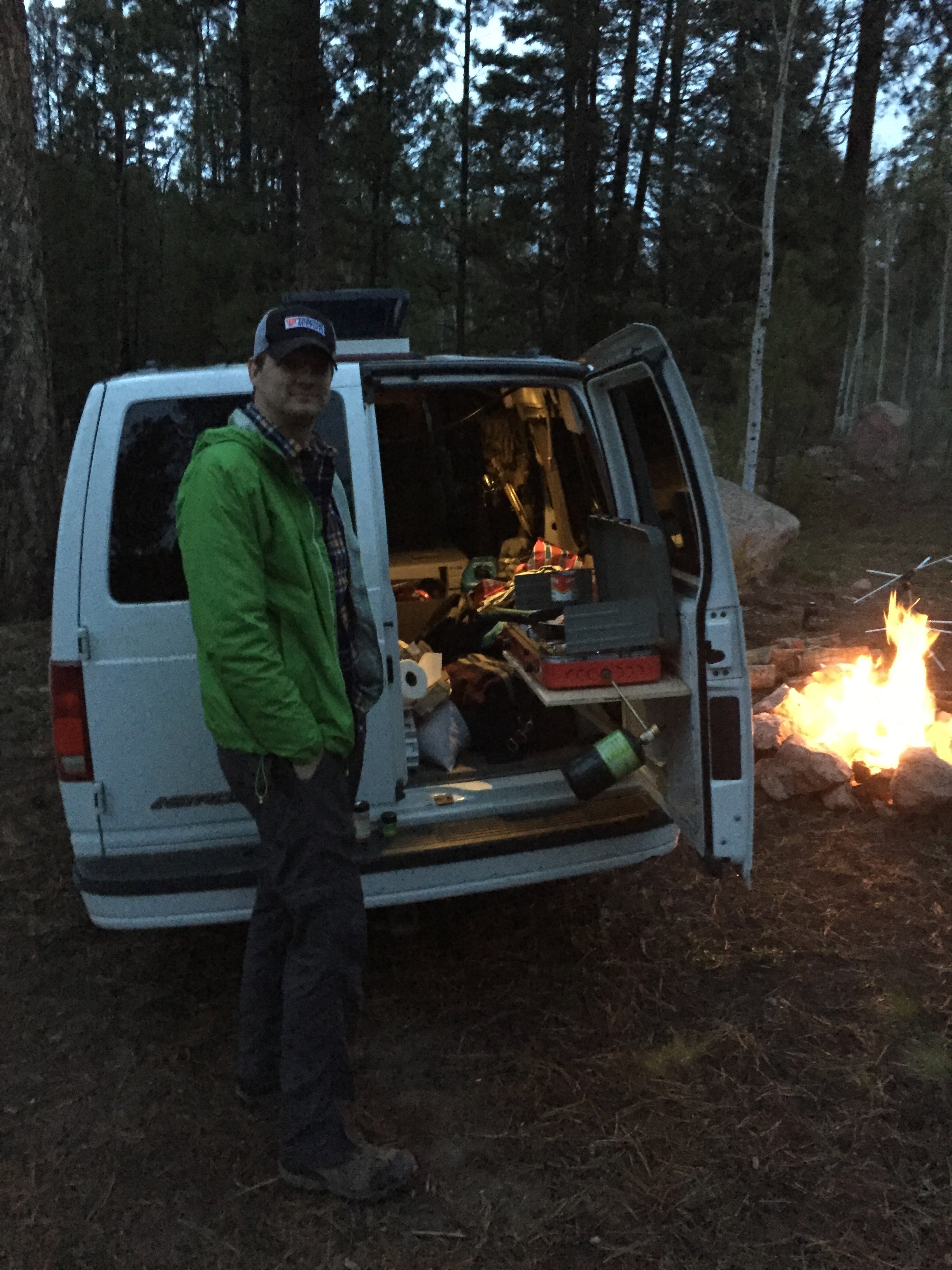
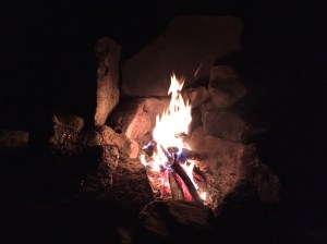
We made a fire as the sun set, then heated up our dinner of Ramen noodles with added powdered eggs, dehydrated veggies and chicken. It was a cloudy night, the moon completely obscured. Now, I never get afraid of the thought of ghosts or monsters while camping; there’s too many real, practical things to fear like wildlife, lightning, hantavirus, flash floods, etc. I don’t know what it was about that night–maybe the initial unsettling discovery of the hair tangled on that tree, or the lack of any moonlight. But for whatever reason, the thought of The Blair Witch Project crossed my mind. And of course once I tried to shake it, it was all I could think about. Just beyond the fire, the forest was enveloped in velvety darkness. When I turned on my headlamp, a beam would illuminate only the handful of trees closest to us, the light dissipating weakly into the black forest. Once I accidentally turned on my headlamp on the strobe setting, and the intermittent flashes of light on the trees, then pitch darkness, made me think of Twin Peaks: Fire Walk with Me, which was even more unsettling. That night, I burrowed deep into my sleeping bag like a dog relying on its thundershirt for comfort and security.